
Galdhøpiggen: A Complete Guide to Hiking Northern Europe’s Highest Mountain
This complete guide to hiking Galdhøpiggen explains the two main routes from Juvasshytta and Spiterstulen, how difficult they are and which option suits different hikers. It also covers the best time to go, weather conditions, what to wear and pack, where to stay, how to reach the trailheads and the most important safety advice for hiking Northern Europe’s highest mountain.
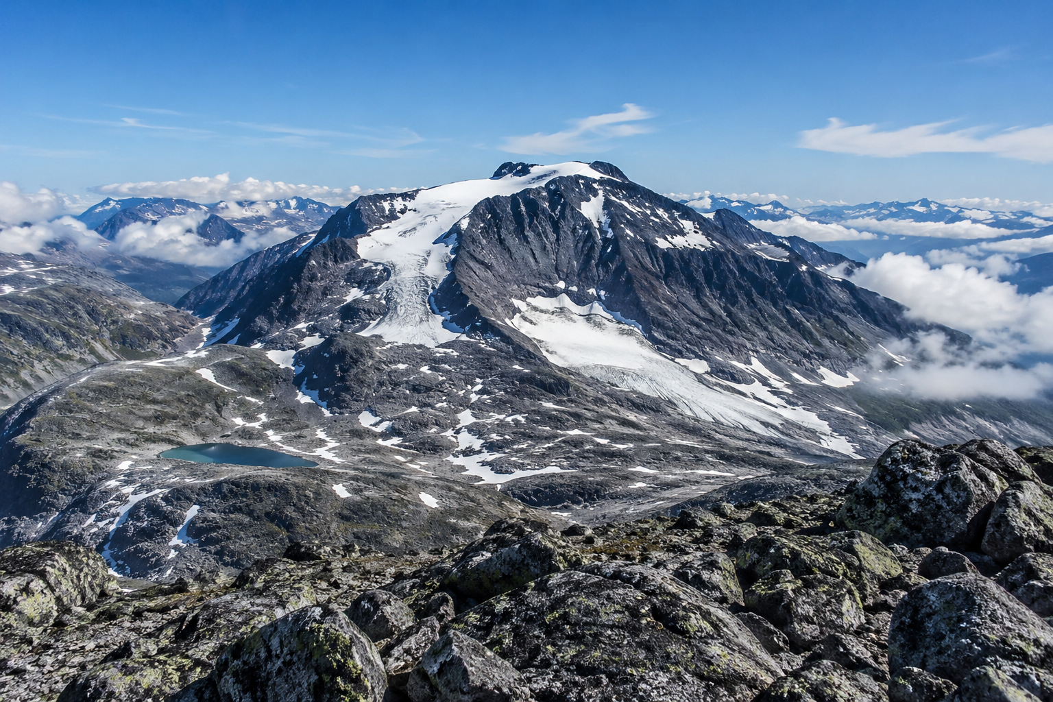
At 2,469 metres above sea level, Galdhøpiggen is the highest mountain in Norway, Scandinavia and Northern Europe. Rising above the glaciers and rocky peaks of Jotunheimen, it attracts experienced mountain hikers, families and first-time summit walkers who want to stand on the highest point in this part of Europe.
You do not need technical climbing experience to reach the summit by either of the two normal summer routes. However, the routes offer very different experiences. The shorter option from Juvasshytta crosses the Styggebreen glacier with a guide, while the route from Spiterstulen avoids the main glacier crossing but involves a much longer and more demanding ascent.
Whichever route you choose, Galdhøpiggen is a full mountain day rather than a casual walk. The terrain is rocky, the weather can change quickly and conditions near the summit may be cold even when the valleys below are warm.
This guide explains the two main routes, how difficult they are, who the hike is suitable for, when to go, what to wear and where to stay.
Galdhøpiggen at a Glance
Height: 2,469 metres above sea level
Location: Lom municipality in Innlandet, Norway
Mountain region: Jotunheimen
Status: The highest mountain in Norway, Scandinavia and Northern Europe
Main starting points: Juvasshytta and Spiterstulen
Main hiking season: Usually June to September, depending on snow, weather and local conditions
Shortest normal route: From Juvasshytta across Styggebreen
Longer normal route: From Spiterstulen through Visdalen
Guide required: Yes for the usual route across Styggebreen, unless you have the necessary glacier experience and equipment. The normal summer route from Spiterstulen can usually be walked independently in suitable conditions.
Technical climbing required: No, not on either of the normal summer routes
Typical duration: Around six to seven hours from Juvasshytta and eight to ten hours from Spiterstulen
Where Is Galdhøpiggen?
Galdhøpiggen lies in Jotunheimen, Norway’s most mountainous region and home to many of the country’s highest peaks. The landscape is defined by high plateaus, glaciers, rocky ridges and deep valleys, with much of the terrain lying above the tree line.
The mountain is located in Lom municipality in Innlandet. Lom village, also known as Fossbergom, is the nearest main settlement and the most practical place to find shops, cafés, fuel and outdoor supplies before travelling farther into the mountains.
However, the hike does not begin in Lom itself. The two normal routes start from separate mountain lodges reached through different valleys:
Juvasshytta, reached through Bøverdalen and along Galdhøpiggvegen
Spiterstulen, reached through Visdalen
This distinction matters when planning both transport and accommodation. The roads, trailheads and hiking routes are different, so staying near one lodge does not necessarily make it convenient to begin from the other.
Galdhøpiggen and Jotunheimen
Galdhøpiggen forms part of the wider Jotunheimen mountain landscape, which contains more than 200 peaks rising above 2,000 metres.
From the summit on a clear day, the view stretches across glaciers, mountain valleys and many of Norway’s highest peaks. This wider setting is an important part of the experience. Galdhøpiggen is not an isolated summit, but the highest point in a vast high-mountain region.
Many visitors travel to Jotunheimen primarily to climb Galdhøpiggen, while others include the hike as part of a longer stay involving Lom, Sognefjellet and other walks in the surrounding mountains.
For more information about accommodation, other hikes and planning a longer stay, read my complete guide to Jotunheimen.
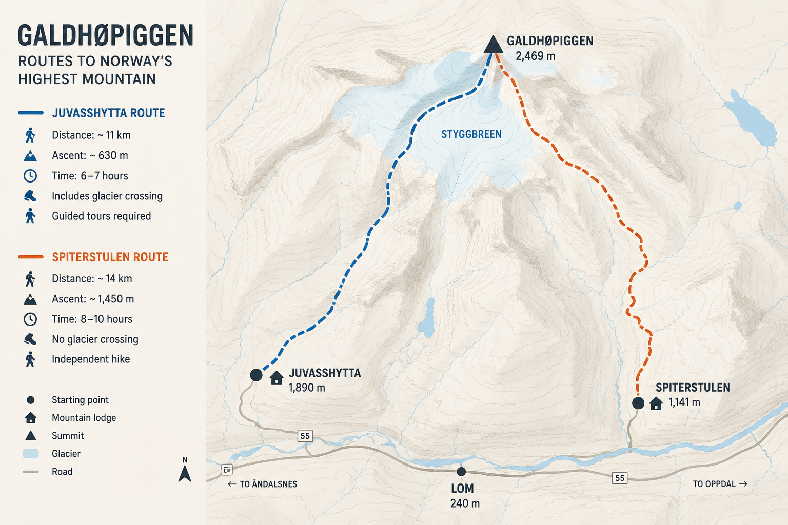
The Two Main Routes to Galdhøpiggen
Most summer visitors choose between two established routes.
The route from Juvasshytta is shorter and involves far less ascent, but it crosses the Styggebreen glacier and is normally completed as part of a guided group.
The route from Spiterstulen does not require the same glacier crossing in normal summer conditions. It can usually be walked independently, but it begins much lower and demands considerably more endurance.
The right route depends less on which one looks shortest on a map and more on your fitness, mountain experience and preference for either a guided or independent hike.
Hiking Galdhøpiggen from Juvasshytta
The route from Juvasshytta is the shortest and most popular way to reach the summit of Galdhøpiggen. The lodge stands at approximately 1,840 metres above sea level, leaving hikers with a little over 600 metres of ascent to the summit. The return journey is around 11 kilometres and usually takes six to seven hours as part of a guided group.
Although this is the less physically demanding of the two main routes, it is not an ordinary marked hike that visitors should attempt independently. The route crosses Styggebreen, where crevasses can be hidden beneath the snow. Unless you have the necessary glacier experience, equipment and rescue knowledge, the crossing must be completed with a guide and in a rope team.
From Juvasshytta to Styggebreen
The hike begins beside Juvasshytta and crosses an open, rocky landscape towards the edge of the glacier. The first section is approximately 2.8 kilometres long and gains around 200 metres in elevation.
There is no technical climbing, but the ground is uneven and covered with stones and boulders. Participants must be able to move steadily enough to keep up with the guided group. The walk to the glacier normally takes slightly less than an hour, although the pace will depend on the group and conditions.
At the glacier edge, the group stops while the guides organise the rope teams and explain how the crossing will work. Harnesses are provided and crampons are supplied when the conditions require them.
Crossing Styggebreen
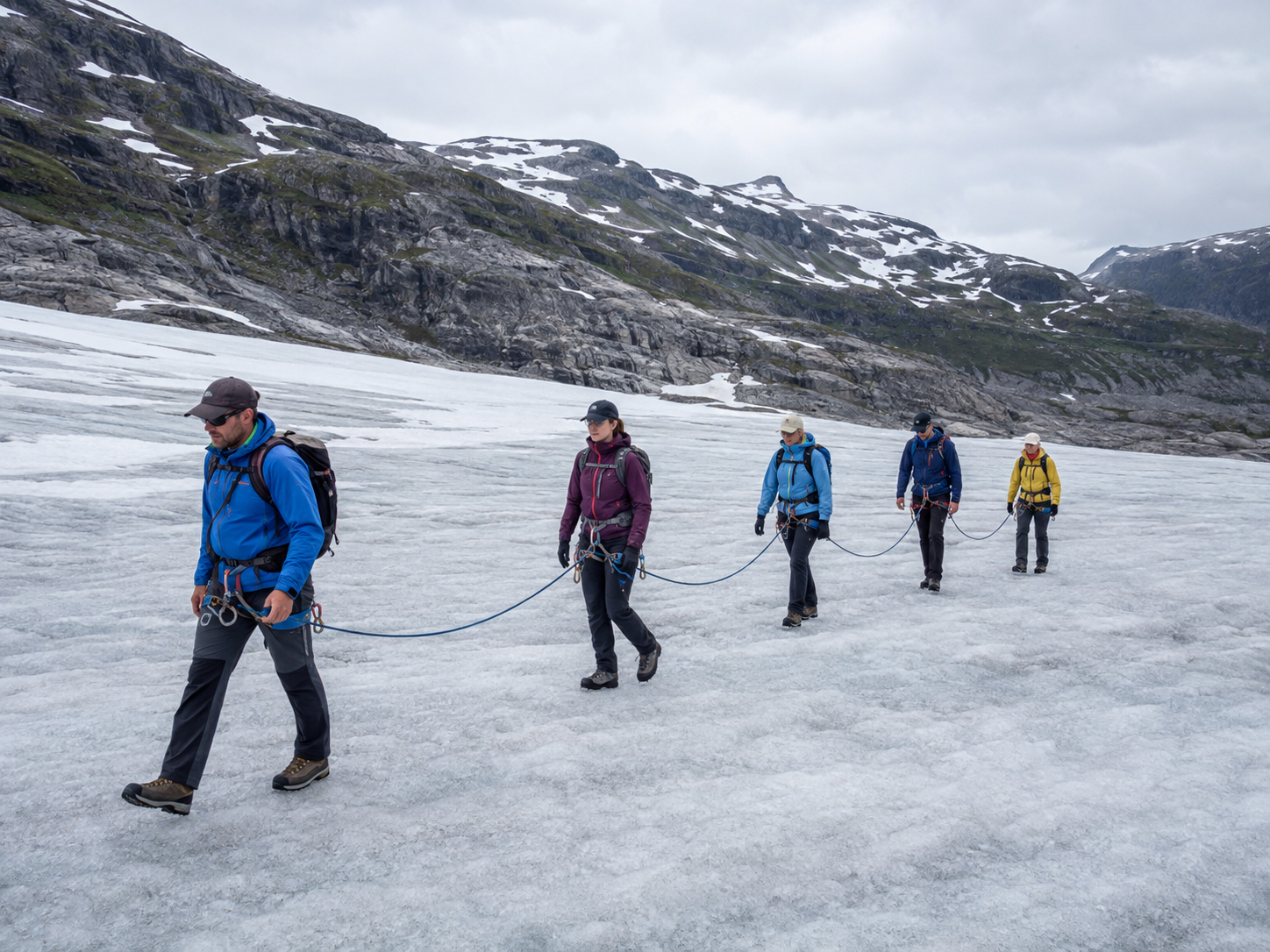
The crossing of Styggebreen normally takes around 50 minutes. Participants walk connected by a rope, maintaining an appropriate distance from one another and following the guide’s instructions.
The glacier is not especially steep along the usual route, and previous climbing or glacier experience is not normally required for a guided trip. However, walking in a rope team means that you cannot choose your own pace or stop whenever you wish. The group must cross together.
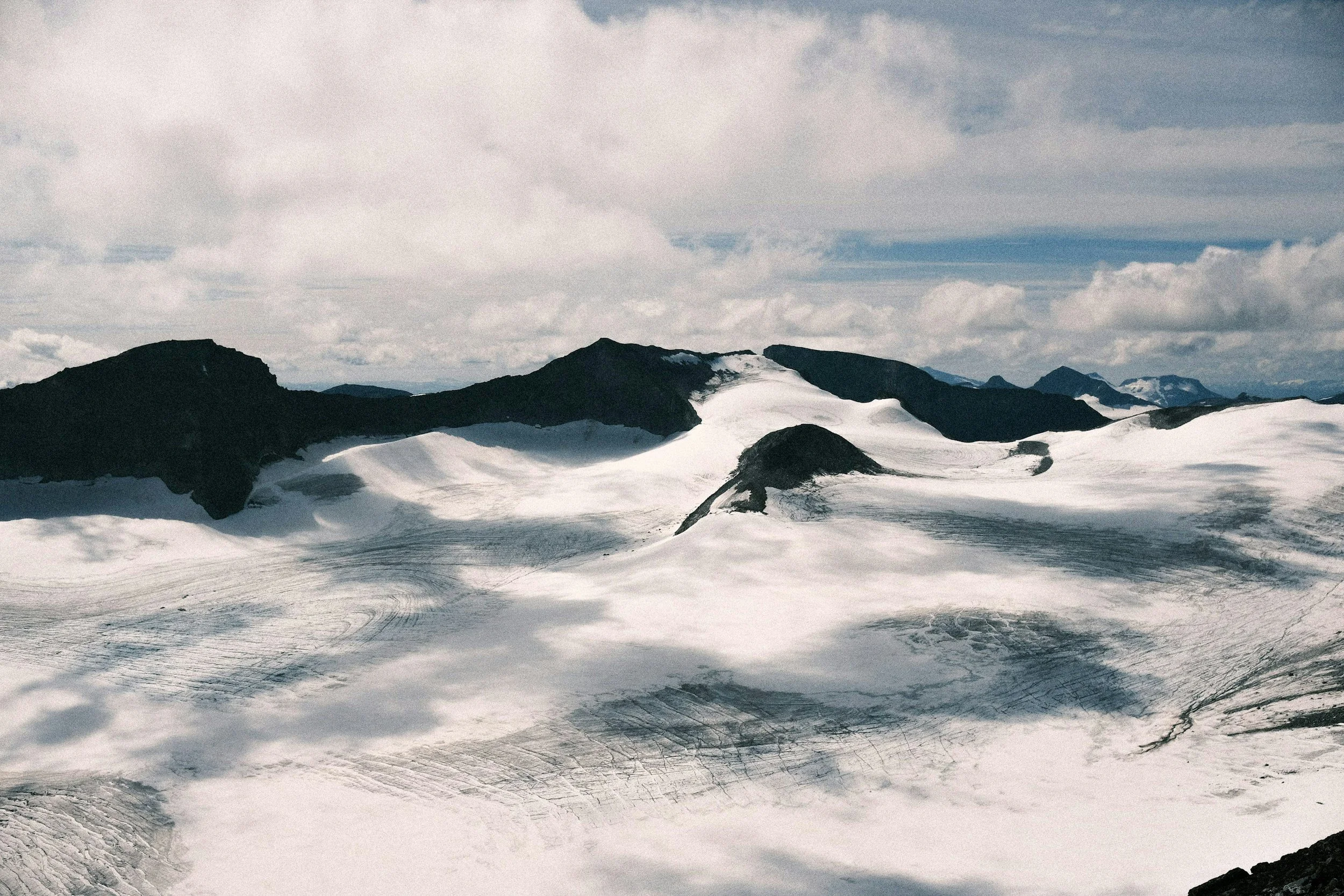
For many visitors, the glacier crossing is what makes the Juvasshytta route especially memorable. The experience feels very different from an ordinary mountain trail, as the rocky landscape gives way to a broad surface of snow and ice beneath the surrounding peaks.
The Final Climb to the Summit
After crossing the glacier, the rope teams are released at the foot of the rocky summit slope. The final section is the steepest part of the route and normally takes between 30 minutes and one hour.
The path climbs through loose stones and scree before reaching the summit at 2,469 metres. On a clear day, the view opens across the glaciers, valleys and peaks of Jotunheimen. In cloud or fog, the views may disappear completely, but reaching the highest point in Northern Europe remains the main achievement of the day.
After a break at the summit, the group returns along the same route and crosses Styggebreen again before walking back to Juvasshytta.
The Juvasshytta route is generally the most practical option for visitors who want a shorter ascent, prefer walking with a guide or would like to experience a glacier crossing as part of the hike.
Hiking Galdhøpiggen from Spiterstulen
The route from Spiterstulen offers a longer and more traditional mountain ascent. It begins at approximately 1,110 metres above sea level in Visdalen and climbs around 1,450 metres before reaching the summit.
The return journey is approximately 12 to 12.5 kilometres. Most hikers should allow around eight to ten hours, including breaks, although the exact duration depends on fitness, conditions and time spent at the summit.
Unlike the normal route from Juvasshytta, the marked summer route from Spiterstulen does not require a glacier crossing. It can therefore usually be completed without a guide when the trail and weather conditions are suitable.
The Ascent from Visdalen
The walk begins near Spiterstulen, crosses the bridge over the river and follows a marked path westwards out of Visdalen. The first section passes through low woodland before emerging above the tree line into increasingly open and rocky terrain.
From here, the route climbs steadily for several hours. There are sections of loose gravel, stones and snowfields, depending on the time of year and recent weather. The path is well established, but the sustained ascent makes this route far more physically demanding than its distance alone might suggest.
Svellnose and Keilhaus Topp
The route continues towards Svellnose at 2,272 metres before crossing Keilhaus topp at 2,355 metres. This means hikers can pass three summits above 2,000 metres during the same journey.
From Keilhaus topp, Galdhøpiggen becomes clearly visible ahead. However, the path descends slightly before the final climb, meaning that some elevation must be regained when the summit appears close.
The last ascent crosses steep, rocky terrain to the summit. By this point, hikers have already been climbing for several hours, and the combination of altitude, loose stones and tired legs can make the final section feel longer than expected.
The Long Descent to Spiterstulen
Most hikers return to Spiterstulen along the same route. The descent is faster than the climb, but losing almost 1,500 metres in elevation places considerable strain on the knees, thighs and ankles.
Loose stones also require concentration when the legs are tired. Reaching the summit is therefore only the halfway point of the day, and hikers need to preserve enough energy for the full descent back into Visdalen.
The Spiterstulen route is best suited to hikers who want to walk independently, are comfortable navigating in mountain terrain and already know that they can manage a long day with substantial ascent and descent.
Juvasshytta or Spiterstulen: Which Route Should You Choose?
The two routes lead to the same summit but provide very different experiences.
From JuvasshyttaFrom SpiterstulenStarting elevationApproximately 1,840 metresApproximately 1,110 metresApproximate distanceAround 11 km returnAround 12–12.5 km returnApproximate ascentAround 630 metresAround 1,450 metresTypical durationAround 6–7 hoursAround 8–10 hoursGlacier crossingYes, across StyggebreenNo, on the normal summer routeGuide requiredYes, unless independently qualified and equipped for glacier travelNormally not in suitable summer conditionsPaceDetermined by the guide and groupDetermined by youMain challengeRough ground, glacier crossing and maintaining the group’s paceThe long and sustained ascent and descentMost suitable forVisitors wanting a shorter, guided experienceFit and experienced independent hikers
For most visitors, Juvasshytta is the easier physical option. It begins much higher, involves less than half the ascent and provides the reassurance of an experienced guide. The compromise is that you must walk as part of a group and cross a glacier in a rope team.
Choose Spiterstulen when you want a longer independent mountain hike and are confident that you can manage nearly 1,500 metres of ascent followed by a demanding descent. Avoid choosing it simply because the standard route does not require a guide.
Can You Hike Up from One Lodge and Down to the Other?
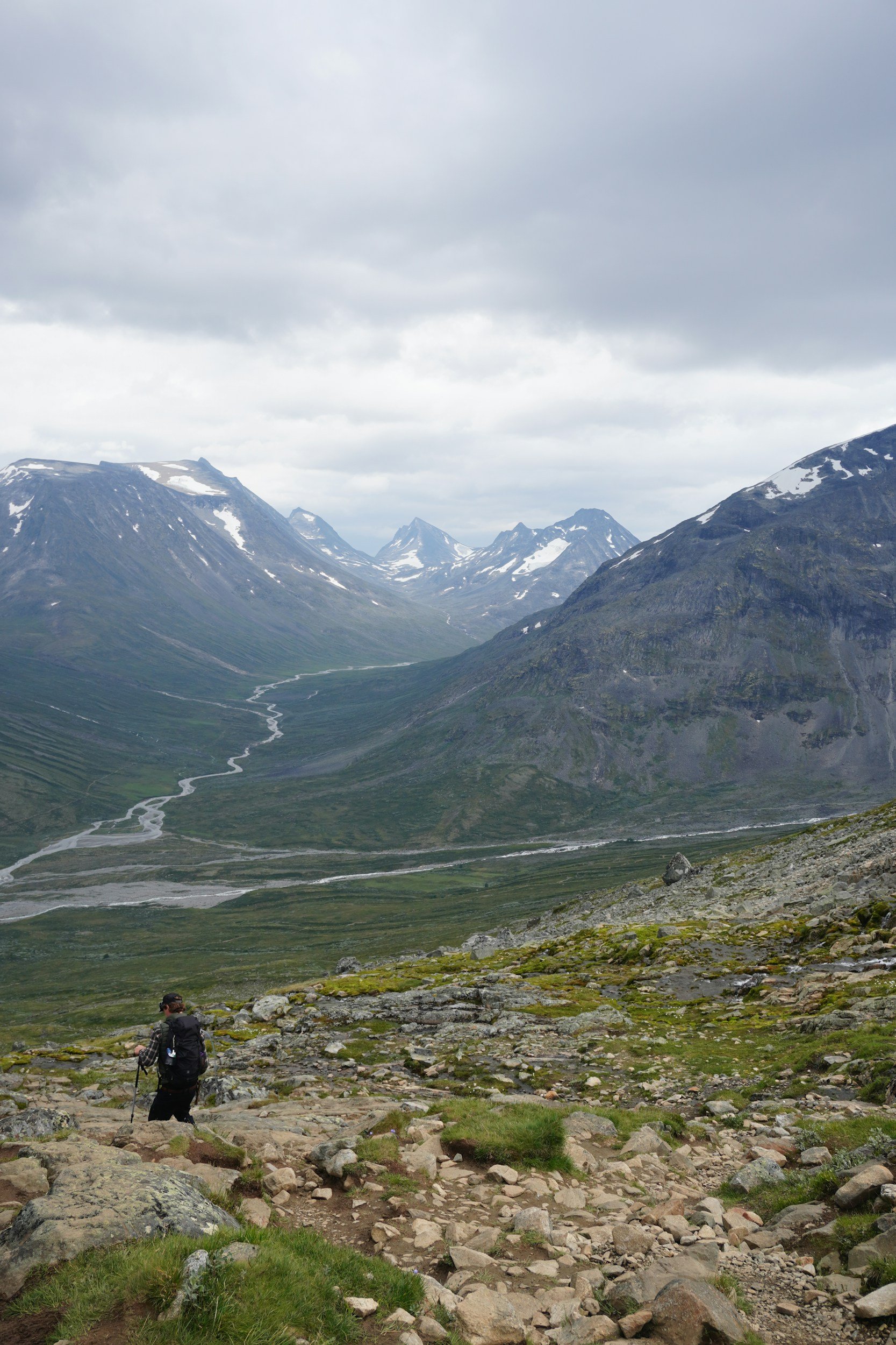
It is possible to include Galdhøpiggen in a route between Spiterstulen and Juvasshytta, but this requires advance planning.
The section between the summit and Juvasshytta crosses Styggebreen. You cannot simply reach the summit from Spiterstulen and decide to descend towards Juvasshytta unless a guided glacier crossing has already been arranged or your group has the necessary glacier competence and equipment.
The two lodges are also reached by separate roads. Transport must therefore be arranged if you leave a vehicle at one trailhead and finish at the other.
For most visitors, returning to the same lodge is the simplest option.
How Difficult Is Galdhøpiggen?
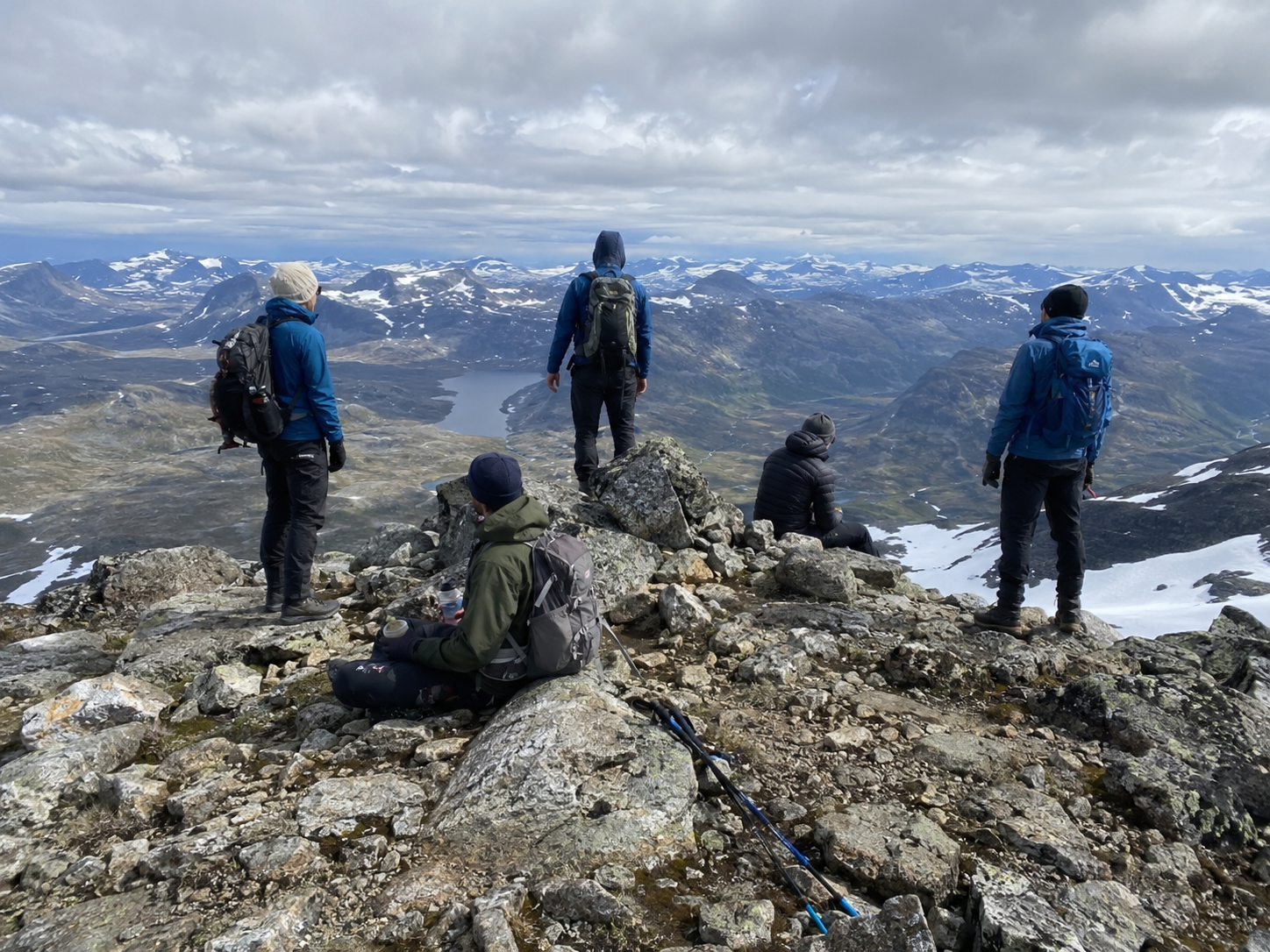
Galdhøpiggen is accessible to ordinary hikers, but it should not be confused with an easy walk. Neither of the normal summer routes requires technical climbing, yet both involve rough mountain terrain, changing weather and several hours of continuous walking.
The main challenge depends on which route you choose. From Juvasshytta, hikers must move steadily across rocky ground, follow the pace of a guided group and cross Styggebreen in a rope team. From Spiterstulen, the challenge is primarily physical, with a long ascent, a demanding descent and a full day spent in exposed mountain terrain.
For many people, the descent is more tiring than expected. Loose stones require concentration, while tired legs place additional strain on the knees and ankles. Reaching the summit is therefore only part of the journey. You must still have enough energy and focus to return safely to the starting point.
Can Beginners Hike Galdhøpiggen?
Yes, a reasonably fit beginner can often hike Galdhøpiggen from Juvasshytta.
You do not need previous glacier or climbing experience when joining an organised trip, as the guides provide instructions and the necessary equipment for crossing Styggebreen. However, you should already be comfortable walking for several hours and moving across uneven ground.
Someone who walks regularly, manages hills without difficulty and has completed a few longer hikes will generally be better prepared than someone whose outdoor experience is limited to short and mostly flat walks.
The route from Spiterstulen is less suitable as a first major mountain hike. It requires considerably more endurance and places more responsibility on the individual for pacing, navigation and decisions in changing conditions.
Beginners who want to climb Galdhøpiggen should usually choose Juvasshytta and complete several longer, hillier walks before travelling.
Can Children Hike Galdhøpiggen?
Many children reach the summit of Galdhøpiggen each summer, particularly via the guided route from Juvasshytta.
Families should check the organiser’s current minimum age and participation requirements before booking, as these may change between seasons. Meeting the formal age limit does not automatically mean that every child is ready for the experience.
A child should already be able to:
enjoy walking for several hours
move confidently over rocks and uneven terrain
follow instructions from guides
keep a steady pace with a group
cope with cold, wind or rain
eat and drink regularly during physical activity
continue walking after reaching the summit
Motivation is just as important as physical ability. A child who enjoys mountain walks may find the glacier crossing and summit exciting, while a child who dislikes long walks may experience the day very differently.
The route from Spiterstulen is generally more appropriate for older and highly experienced hiking children. The long ascent and descent make it a demanding family objective, even in good weather.
Carrying a young child over the rocky terrain is usually not advisable. A framed carrier affects the adult’s balance, while the child remains inactive and may become cold during a long day at altitude.
Can Older Hikers Complete Galdhøpiggen?
There is no general upper age limit for hiking Galdhøpiggen. Fitness, balance and recent mountain experience are more important than age alone.
An older person who walks regularly and is comfortable on rocky terrain may be better prepared than a much younger but inactive visitor. The main considerations are usually endurance, stability and how the knees and hips cope with a long descent.
Walking poles can improve balance and reduce some of the strain on downhill sections. Hikers who are uncertain about managing the long ascent from Spiterstulen may find the guided route from Juvasshytta more realistic.
The most useful test is not age, but whether you can already complete a long and hilly walk without significant pain, exhaustion or loss of balance.
Can You Bring a Dog?
Dogs may be able to join the hike, but owners should check the current rules with the relevant lodge or guide company before travelling.
A dog suitable for Galdhøpiggen should be healthy, accustomed to long walks and comfortable on rough, rocky ground. It must also be able to remain calm around groups of hikers and other dogs.
The terrain can be hard on paws, particularly during the descent. Owners should inspect the dog’s pads before the hike and carry basic paw-care supplies. A dog that begins limping, slowing down or showing signs of discomfort should not be pushed towards the summit.
The guided route from Juvasshytta also requires the dog to function safely within a group and around rope teams. The route from Spiterstulen avoids the standard glacier crossing, but it involves a much longer day and considerably more climbing.
Bringing a dog should therefore be based on the animal’s experience and physical ability, not simply on whether dogs are permitted.
How to Prepare for Galdhøpiggen
You do not need a complicated training programme, but you should know how your body responds to several hours of uphill and downhill walking before arriving at the trailhead.
The most useful preparation is regular hiking that gradually becomes longer and more demanding.
Before the trip, try to:
complete several walks lasting four to six hours
include hills and uneven paths
practise both climbing and long descents
carry the backpack you plan to use
wear your hiking boots enough to know they are comfortable
walk in less-than-perfect weather rather than training only on warm, dry days
For the route from Spiterstulen, you should ideally have completed at least one long mountain day involving substantial ascent and descent. You should finish that practice walk tired, but still able to move safely and maintain concentration.
Strength and balance can also help. Simple exercises such as step-ups, squats, lunges and stair walking can make prolonged climbing and descending more manageable.
The purpose of preparation is not to become exceptionally fast. It is to build enough endurance that you can continue walking steadily when the terrain becomes steeper, the weather changes or your legs begin to tire.
How Can You Tell Whether You Are Ready?
Before choosing a route, consider whether you can comfortably:
walk for most of a day
climb continuously for several hours
move across loose stones without repeatedly losing balance
carry food, water and extra clothing
continue safely when tired
cope with cold, wind or rain
turn back if conditions or energy levels become unsuitable
For Juvasshytta, the ability to maintain a steady group pace is particularly important.
For Spiterstulen, endurance and experience of long mountain days matter more than speed.
You do not need to train like a mountaineer to climb Galdhøpiggen, but the hike should not be the first time you discover how your body reacts to a full day in steep and uneven terrain.
The Best Time to Hike Galdhøpiggen
The main hiking season for Galdhøpiggen usually runs from June to September, although snow and weather conditions vary from year to year.
July and August generally offer the most accessible summer conditions, but there is no month in which warm weather, clear views or a snow-free route can be guaranteed. Conditions near the summit may remain cold and wintry even when the valleys below feel like summer.
The best time to go therefore depends on more than the calendar. Current snow conditions, wind, visibility and local advice should always be considered before setting out.
Hiking Galdhøpiggen in June
June often provides a more wintry version of the mountain.
Large areas of snow may remain on both routes, and some paths and trail markings can still be partly covered. Conditions may feel cold near the summit, while the snow can make walking slower and more tiring than later in the summer.
Guided trips from Juvasshytta may already be operating, but the experience can vary considerably depending on how much snow remains after winter.
Independent hikers starting from Spiterstulen need to be particularly cautious when snow obscures the path or creates icy sections. A route that is straightforward later in the season may require stronger navigation skills and greater confidence on snow in early summer.
June can be a rewarding time for experienced hikers who want quieter surroundings and a more dramatic snow-covered landscape. First-time visitors should be prepared for conditions that may feel closer to spring or winter than summer.
Hiking Galdhøpiggen in July and August
July and August form the main hiking season and are usually the most practical months for first-time visitors.
The mountain lodges, access roads and guided services are normally operating, and the two main routes are generally closest to ordinary summer conditions. Long daylight hours also provide more time to complete the hike without feeling rushed.
These months offer the greatest likelihood of:
regular guided departures from Juvasshytta
open accommodation and mountain services
accessible roads to the main starting points
more visible paths and trail markings
opportunities to combine Galdhøpiggen with other walks in Jotunheimen
However, summer conditions do not mean consistently warm or dry weather. Snow can remain on parts of the mountain, fresh snow may fall and the summit can still experience strong wind, fog and temperatures close to freezing.
July is normally the busiest period, particularly during Norwegian school holidays and on weekends with a favourable forecast. Guided trips and accommodation may need to be booked in advance.
August can feel slightly quieter later in the month, while the routes are often at their most exposed and snow-free. The days gradually become shorter, however, and colder autumn weather can begin earlier than many international visitors expect.
The small differences between July and August matter less than the conditions on the day itself. A calm and clear day in August is usually a better choice than a fixed July date with strong wind and poor visibility.
Hiking Galdhøpiggen in September
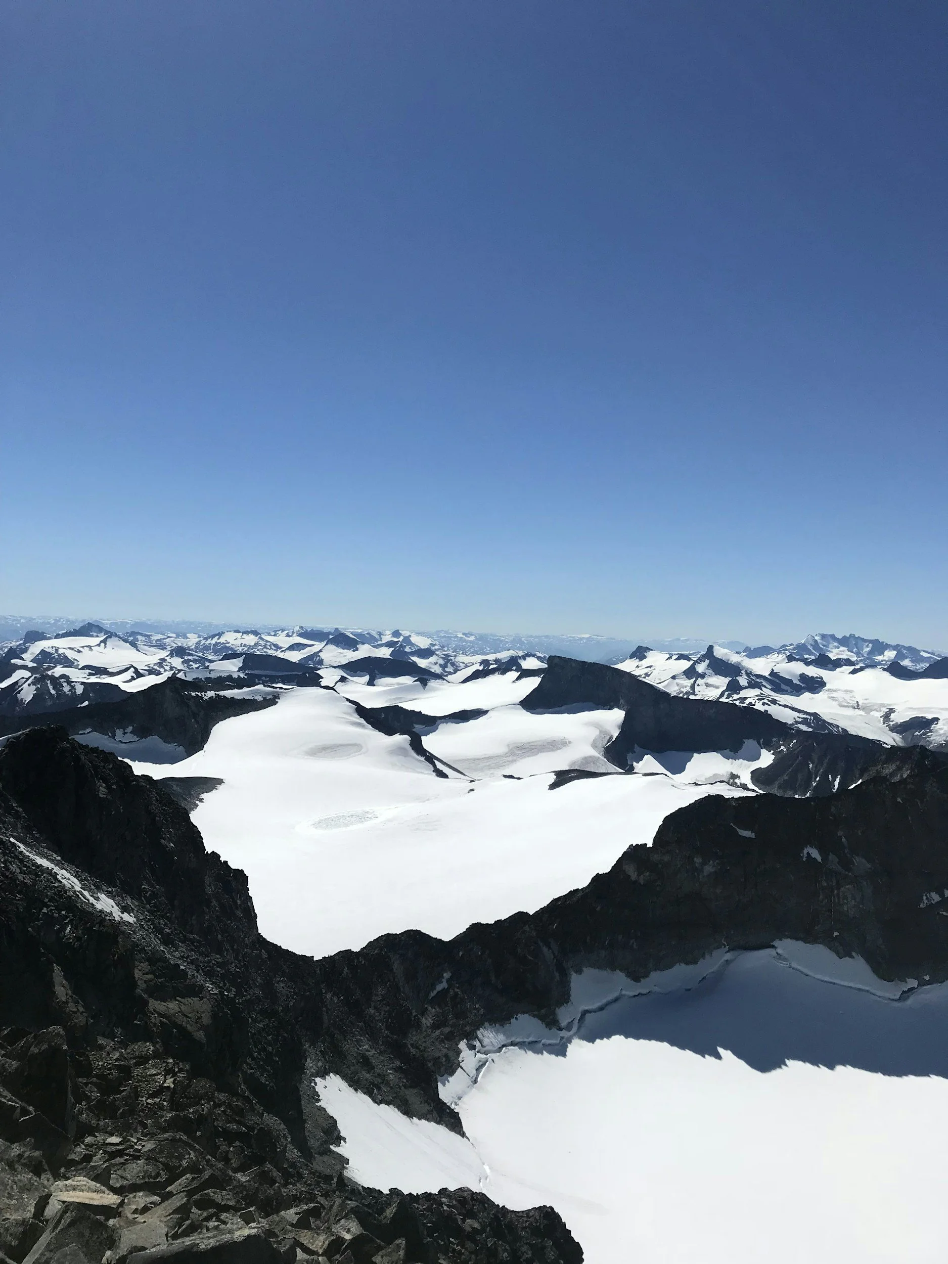
September can offer quieter trails and a more peaceful experience, but the conditions become less predictable as autumn progresses.
Temperatures fall, daylight decreases and frost or fresh snow may affect the higher parts of the mountain. Wet rocks can freeze overnight, while early snowfall may cover the trail and make navigation more difficult.
Guided departures, accommodation and seasonal roads may also begin to close during September. The exact dates vary between years, so hikers should check directly with Juvasshytta, Spiterstulen and local transport providers before planning a late-season visit.
Early September may still offer suitable hiking conditions, particularly during stable weather. Later in the month, visitors should be prepared for the possibility that the mountain feels more like winter than autumn.
Flexibility becomes especially important at this time of year. A late-season summit attempt should never be treated as guaranteed simply because the lodge or road remains open.
Can You Hike Galdhøpiggen Outside Summer?
Galdhøpiggen can be climbed during winter and spring, but this is a very different undertaking from following the normal summer routes.
Snow may hide paths, cairns and other landmarks, while ski travel, winter navigation and an understanding of snow and avalanche conditions may be required. The access roads and mountain lodges also have separate seasonal opening periods.
The normal summer description of the route should not be used as a complete guide for a winter ascent. Hikers without extensive winter mountain experience should join a qualified local guide rather than attempting to adapt the summer route independently.
When Is the Best Time for First-Time Hikers?
For most first-time visitors, July or August is the most practical choice.
The roads, lodges and guided services are normally operating, and the routes are generally closest to summer conditions. These months also provide the greatest flexibility for choosing between the two starting points.
However, the date alone should never determine whether you set out. Wind, visibility, precipitation and recent snow are more important than whether the trip takes place in July or August.
When possible, stay in the area for more than one night and keep several potential hiking days available. This allows you to choose the most suitable conditions rather than forcing the mountain into a fixed itinerary.
Weather on Galdhøpiggen
Weather is one of the most important factors when planning a hike to Galdhøpiggen. Conditions at 2,469 metres can be significantly colder, windier and less predictable than they are in Lom or at the starting points below.
A warm morning in the valley does not guarantee comfortable conditions near the summit. During the same hike, you may experience sunshine, cloud, rain, strong wind, fog and even snow. There is also very little shelter once you are above the tree line, so changes in the weather are felt immediately.
Temperature generally falls as elevation increases. Galdhøpiggen’s summit stands more than 600 metres above Juvasshytta and approximately 1,350 metres above Spiterstulen. The difference is even greater from Lom village, which lies almost 2,100 metres below the summit.
Wind can make the temperature feel considerably colder, particularly when clothing is wet or you stop moving. Even on a mild summer day, hikers may need warm layers, gloves and a hat during the final ascent or while resting at the summit.
Snow is also possible during the summer months. Old snow often remains on parts of the mountain, while fresh snow may briefly cover rocks and trail markings. The Juvasshytta route crosses a glacier, so snow and ice are a normal part of that journey rather than an unusual summer event.
Fog can be especially challenging. The wide views across Jotunheimen may disappear quickly, leaving hikers surrounded by cloud, pale rock and snow. Poor visibility makes distances harder to judge and may obscure paths, cairns and the people ahead.
On the guided route from Juvasshytta, the guide is responsible for navigation and managing the group. Independent hikers from Spiterstulen must be able to follow the route themselves and should not rely only on seeing other walkers ahead.
Rain can also change the difficulty of the terrain. Wet rocks become slippery, while the combination of rain, wind and low temperatures can cool the body quickly. The long descent from Spiterstulen requires particular care when stones are wet and legs are already tired.
How to Check the Forecast
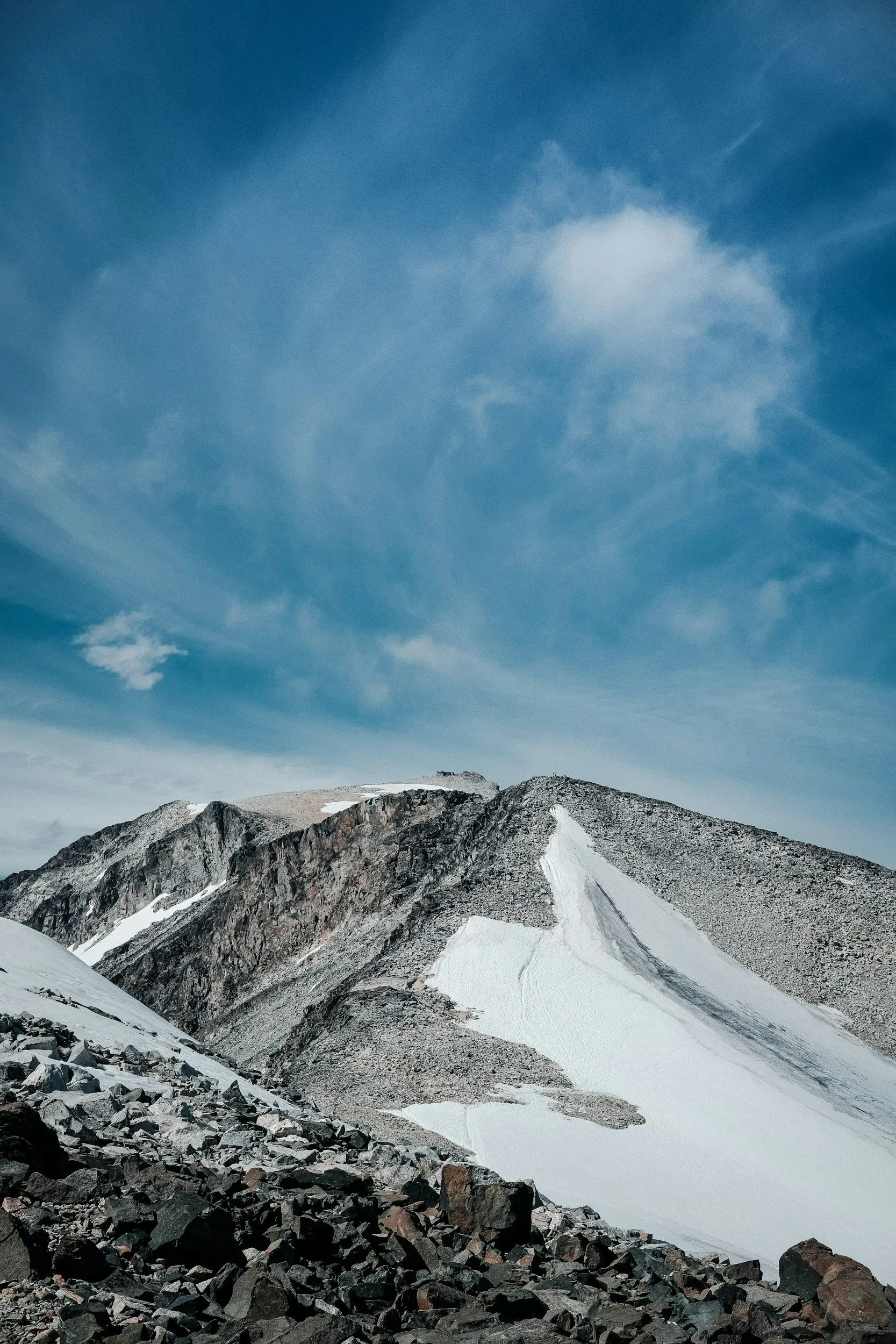
Do not rely only on the forecast for Lom village. Conditions in the valley can differ considerably from those at the summit.
Before setting out, check:
the forecast for Galdhøpiggen or the surrounding mountain area
wind speed at higher elevations
expected precipitation
cloud level and visibility
recent information from Juvasshytta or Spiterstulen
current snow and trail conditions
Forecasts viewed several days in advance are useful for general planning, but the final decision should be made as close to the hike as possible. Conditions can change overnight, and local lodge staff or guides may have more relevant information than a general regional forecast.
Download any maps or weather information you may need before leaving. Mobile coverage should not be treated as guaranteed, and cold temperatures can reduce phone battery life.
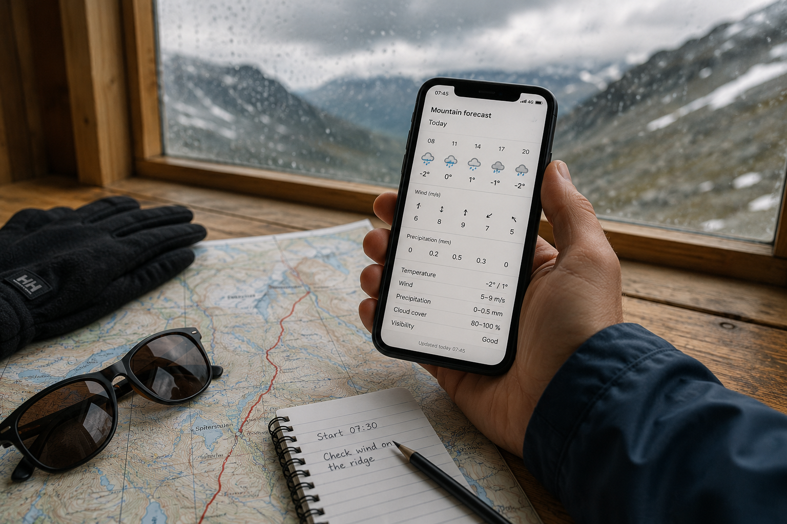
What Happens if the Weather Is Poor?
A guided trip from Juvasshytta may still proceed in cloud, light rain or limited visibility if the guide considers the conditions safe. However, the route may be changed, delayed, shortened or cancelled when wind, snow or visibility creates an unacceptable risk.
Independent hikers from Spiterstulen must make these decisions themselves. The fact that other people continue towards the summit does not mean that the conditions are suitable for your experience, clothing or energy level.
Turning around because of deteriorating weather is a normal part of mountain hiking. The summit will still be there on another day, while poor visibility and strong wind can make navigation and safe movement increasingly difficult.
When possible, allow more than one potential hiking day in your itinerary. A flexible stay gives you time to compare forecasts, speak to local staff and choose the most suitable conditions.
The mountain should determine the day, rather than the itinerary forcing the mountain into a fixed schedule.
What to Wear and Pack for Galdhøpiggen
What you wear on Galdhøpiggen should be based on the conditions near the summit, not on the temperature in Lom or at the trailhead.
Even during July and August, the upper mountain can be cold, windy and wet. Several light layers are therefore more practical than one heavy jacket, as they can be added or removed throughout the day.
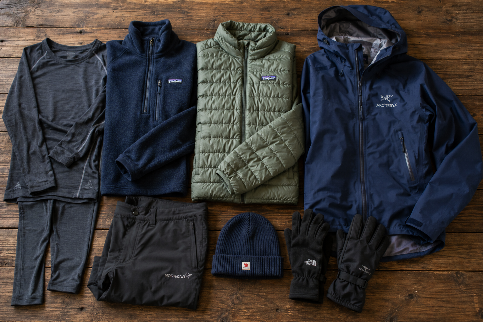
What to Wear
Start with a wool or synthetic base layer that moves moisture away from the skin. Cotton dries slowly and can become cold when damp, particularly during breaks or in strong wind.
Over this, wear or carry an insulating layer such as a fleece, wool jumper or lightweight insulated jacket. You may not need it during the climb, but it can become important near the summit or whenever the group stops moving.
A waterproof and windproof outer jacket is essential. Waterproof overtrousers are also worth carrying, even when the forecast appears dry. Ordinary jeans are unsuitable because they absorb water, restrict movement and become cold when wet.
Bring a warm hat and gloves regardless of the month. They take up little space and can make a considerable difference if the wind increases or the temperature drops.
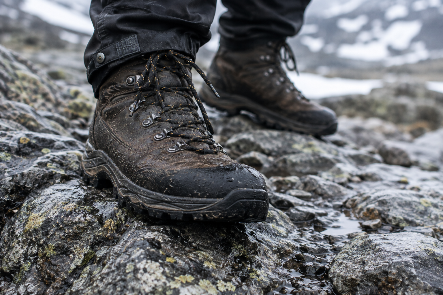
Hiking Boots
Wear sturdy hiking boots with good grip.
Both routes include loose stones, uneven ground and possible snow. The long descent from Spiterstulen places additional pressure on the feet and ankles, while appropriate footwear is also expected on the guided route from Juvasshytta.
Your boots should already be broken in before the hike. Wear them on several longer walks with the same socks you plan to use on Galdhøpiggen.
Lightweight trainers may feel comfortable at the start but provide less grip, protection and support on wet rocks, snow and loose scree.
Sun Protection
Cold weather does not remove the risk of sun exposure.
Snow and ice reflect sunlight, while much of the hike takes place in open terrain without shade. Bring sunglasses, sunscreen and lip protection. A cap can also be useful in calm weather, provided it fits securely enough not to blow away.
Walking Poles
Walking poles are optional, but they can improve balance and reduce some of the strain on the knees during the descent.
They are particularly useful on the route from Spiterstulen, where hikers lose almost 1,500 metres in elevation on the return journey. Practise using them before the hike rather than carrying them for the first time on the mountain.
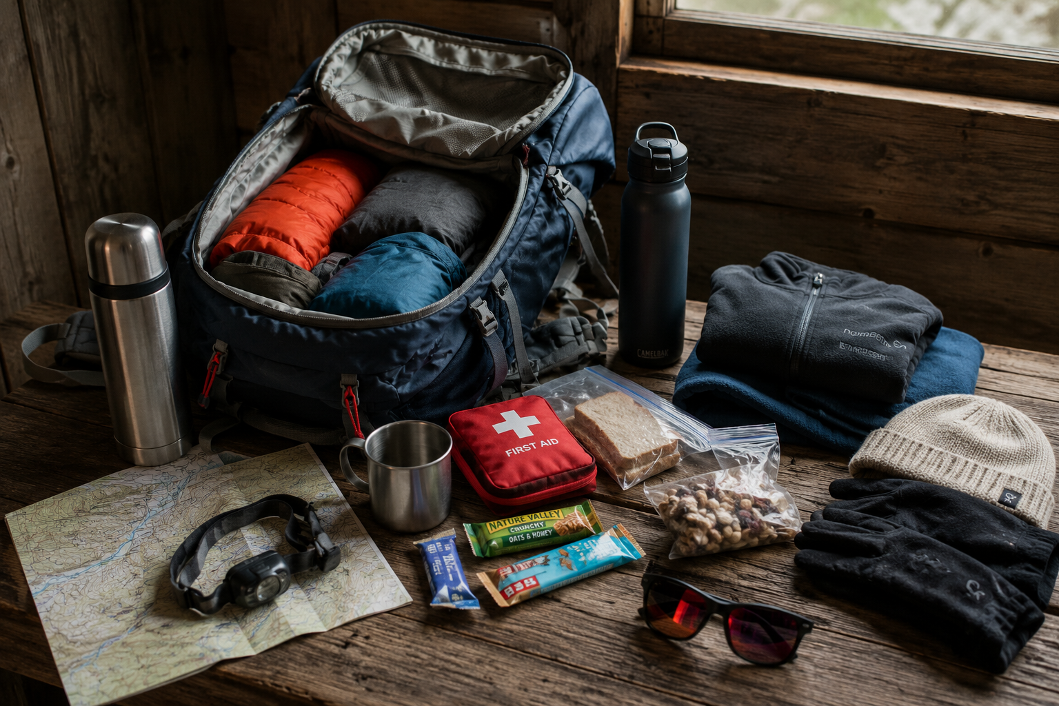
What to Pack
A small day-hiking backpack should be large enough to carry food, water and the extra clothing you may need when conditions change.
For a summer hike, pack:
waterproof jacket and trousers
a warm insulating layer
hat and gloves
food for the full day
energy-rich snacks
enough drinking water
sunglasses and sunscreen
a map or downloaded offline route
a fully charged phone
a small power bank
basic first-aid supplies
blister plasters
personal medication
a small bag for rubbish
A spare pair of socks can also be useful if your feet become wet.
You do not need to fill the backpack with specialist expedition equipment for an ordinary guided summer trip from Juvasshytta. However, you should carry enough to remain warm, fed and comfortable if the hike takes longer than expected.
Food and Water
Bring food that is easy to eat during short breaks and remains appealing in cold weather.
Sandwiches, wraps, fruit, nuts, chocolate and energy bars are all practical choices. Several smaller snacks are often more useful than relying on one large lunch.
Eat and drink regularly rather than waiting until you feel exhausted or extremely thirsty. Maintaining steady energy levels is especially important during the final ascent and the return journey.
The amount of water you need depends on the weather, route and individual, but you should not assume that water will be conveniently available or safe to drink along the way.
A thermos with a warm drink is optional, but it can be welcome during colder conditions.
Equipment for the Glacier Crossing
On the ordinary guided route from Juvasshytta, the organiser provides the equipment required for crossing Styggebreen, including the harness and other glacier safety equipment used by the group.
Participants remain responsible for their own hiking boots, clothing, food, water and personal items.
The guide may decide which glacier equipment is needed based on current snow and ice conditions. Previous climbing experience is not normally required, but suitable footwear and clothing are still essential.
Keep the Backpack Manageable
Carry what you need, but avoid packing so much that the weight becomes an unnecessary burden.
A heavy backpack makes climbing more tiring and can affect balance on uneven terrain. Before travelling, take a practice walk with the fully packed bag to check that it is comfortable and that the straps are adjusted correctly.
Keep frequently needed items such as gloves, snacks and waterproof clothing easy to reach. You should not need to empty the entire backpack whenever the weather changes.
Where to Stay for Galdhøpiggen
The most practical place to stay depends on which route you plan to take. Juvasshytta and Spiterstulen are located beside their respective trailheads, while Lom offers more choice but requires a drive into the mountains before the hike.
Juvasshytta
Juvasshytta is the most convenient place to stay when joining the guided route across Styggebreen.
The lodge stands at approximately 1,840 metres above sea level and is the closest accommodation to the summit. Guided trips begin at Juvasshytta, so overnight guests can prepare for the hike without driving up the mountain early in the morning.
Accommodation and meals are available during the lodge’s operating season. Its isolated setting is part of the experience, but it also means that you should buy any special food, medication or equipment before leaving Lom or Bøverdalen.
Juvasshytta is particularly practical for families, first-time visitors and anyone who wants the simplest possible start to the guided hike.
Spiterstulen
Spiterstulen is the natural base for the long route through Visdalen.
The marked path begins beside the lodge, allowing hikers to start early without driving immediately before a demanding mountain day. Spiterstulen offers different types of rooms, meals and facilities for campers and motorhomes during its operating seasons.
Staying at the trailhead is especially valuable after the hike. Instead of facing another journey when you are tired, you can return directly to the lodge for food, warmth and rest.
Spiterstulen also provides access to other walks in Visdalen, making it a useful base when poor weather prevents a Galdhøpiggen attempt.
Lom
Lom is the most flexible base for visitors spending several days in the region.
The village has a wider selection of hotels, guesthouses, camping facilities, shops and places to eat than the mountain lodges. It also works well when you want to explore other parts of Jotunheimen or wait for the most suitable weather before choosing a summit day.
The disadvantage is that neither hiking route begins in Lom. You must drive or arrange transport to Juvasshytta or Spiterstulen before starting the walk.
For a wider overview of hotels, mountain lodges and other places to stay in the region, read my complete guide to Jotunheimen.
How to Get to Galdhøpiggen
There is no single entrance to Galdhøpiggen. The two normal routes begin from separate valleys and are reached by different mountain roads.
For most visitors, travelling by car is the simplest option. It provides greater flexibility when choosing a hiking day and makes it easier to reach the trailhead early in the morning.
Before setting out, make sure that your navigation is directing you to the correct lodge. Driving towards Juvasshytta when you intend to walk from Spiterstulen will not bring you to the same side of the mountain.
Driving to Juvasshytta
Juvasshytta is reached through Bøverdalen from road 55, the Sognefjellsvegen.
From the valley, Galdhøpiggvegen climbs towards the lodge through increasingly open mountain terrain. The road is private, seasonal and subject to a toll. It is normally open while Juvasshytta is operating, but snow and local conditions determine the exact opening period.
The road gains considerable elevation and may feel steep or exposed to drivers who are unfamiliar with Norwegian mountain roads. Allow enough time and avoid planning to arrive only a few minutes before the guided departure.
You will need time to park, check in, use the facilities and prepare your clothing and backpack before the group leaves.
Driving to Spiterstulen
Spiterstulen is reached by following Visdalsvegen from Bøverdalen into Visdalen.
Visdalsvegen is a private mountain road that connects road 55 with the lodge. Like the road to Juvasshytta, it operates seasonally and is subject to a toll.
The road ends at Spiterstulen, where parking is available. Parking arrangements differ for overnight guests and day visitors, so check the lodge’s current information before travelling.
Anyone planning to start early should consider staying at Spiterstulen the previous night. The walk is already long, and adding a substantial drive before and after it can make the day unnecessarily tiring.
Reaching Galdhøpiggen without a Car
Visiting without a car is possible, but it requires more planning.
Regional buses can bring travellers to Lom and Bøverdalen, and seasonal transport may operate farther into the mountains. Services, routes and departure times can change between seasons, so they should be checked as part of the trip planning rather than assumed to operate every day.
Depending on the route and time of year, your options may include:
using a seasonal mountain bus
arranging a taxi from Lom
staying at the trailhead
joining an organised trip that includes transport
combining public transport with an overnight stay in Bøverdalen
Contact Juvasshytta or Spiterstulen directly when planning a car-free trip. The lodges are better placed to advise on the transport options available during their current season.
For more detailed information about reaching Jotunheimen from Oslo, Bergen and other parts of Norway, read my complete Jotunheimen travel guide.
Road Access, Tolls and Parking
Both main trailheads are reached by private, seasonal roads.
The exact road-opening dates, toll systems and parking arrangements may change. Before travelling, check:
whether the access road is open
the current road toll
how the toll must be paid
whether day visitors pay separately for parking
the latest recommended arrival time
whether weather or maintenance is affecting access
Do not rely entirely on information from an older itinerary or travel blog. Check the official lodge or destination website shortly before the journey.
Facilities at the Starting Points
Both Juvasshytta and Spiterstulen provide facilities at the beginning and end of the hike.
At Juvasshytta, visitors can find accommodation, food service and toilets near the parking and meeting area.
Spiterstulen has accommodation, a restaurant, café and toilets. Some facilities and guest areas may be reserved for paying guests or campers, so day visitors should follow the instructions provided by the lodge.
Use the toilets before setting out and carry everything you need for the full journey. You should not expect regular facilities, water points or staffed rest stops between the lodge and the summit.
The Summit Hut
A small hut known as Piggjehytta stands at the summit of Galdhøpiggen.
The first summit hut was built in 1888, and the current hut is owned by Juvasshytta. When it is staffed, visitors may be able to buy hot drinks, simple refreshments and souvenirs.
The summit hut adds character to the experience, particularly in cold or windy weather, but it should not form part of your essential plan. Access and service may depend on the season, weather and staffing.
Bring enough food, water and warm clothing to complete the hike even when the hut is unavailable. Payment systems may also depend on a functioning network connection.
Phone Coverage and Navigation
Carry a fully charged phone, but do not make it your only method of navigation or your entire safety plan.
Download the route and any relevant maps before leaving the lodge. Keep the phone protected from rain and cold, and carry a small power bank if you expect to use it for navigation or photographs throughout the day.
The guided group from Juvasshytta manages the route and glacier crossing, but participants should still know where they are going and carry their own basic information.
Independent hikers from Spiterstulen are responsible for following the route themselves. Poor visibility can obscure paths and markers, so seeing other people ahead should never be treated as a substitute for navigation.
Plan the Morning Before You Arrive
Prepare as much as possible the evening before the hike.
Check the latest weather and local conditions, pack your backpack, fill your water bottles and make sure that your boots and outer layers are ready. Confirm the departure time if you are joining a guided trip and find out how long you need for the drive.
Beginning the day calmly is better than arriving late, rushing through the car park and discovering that food, gloves or waterproof clothing have been left behind.
Essential Safety Advice
Galdhøpiggen is a popular mountain, but its accessibility should not make the risks of high-altitude weather, glaciers and rough terrain seem insignificant.
Keep the following principles in mind:
Do not cross Styggebreen without a guide unless your group has the necessary glacier knowledge, rescue skills and equipment.
Check the latest weather and local conditions on the morning of the hike.
Carry clothing suitable for cold, wind and precipitation, even when the valley forecast appears warm.
Download the route before leaving and do not rely entirely on phone coverage or other hikers for navigation.
Maintain enough food, water and energy for the descent, not only for reaching the summit.
Follow the guide’s instructions when walking from Juvasshytta.
Turn around when weather, visibility, injury or exhaustion makes continuing unsafe.
Tell someone which route you are taking and when you expect to return if hiking independently.
Other hikers continuing uphill should not determine your own decision. They may have more experience, different equipment or a guide that you cannot see.
A summit attempt is successful only when everyone returns safely to the starting point.
Final Words
Hiking Galdhøpiggen offers the chance to experience the high mountains of Jotunheimen and stand at the highest point in Northern Europe.
The route from Juvasshytta makes the summit accessible through a shorter guided journey and a memorable glacier crossing. The route from Spiterstulen offers a longer and more independent mountain day for hikers with the endurance and experience to manage the sustained climb and descent.
Neither route requires technical climbing under normal summer conditions, but both deserve preparation and respect. Choose the route that matches your actual experience rather than the one that appears most impressive, allow flexibility for the weather and arrive equipped for conditions at 2,469 metres.
The summit view may be wide and clear, or it may disappear entirely into cloud. Either way, the journey across the rock, snow and high-mountain landscape is what makes Galdhøpiggen more than simply the highest point on a map.
More articles about Norway
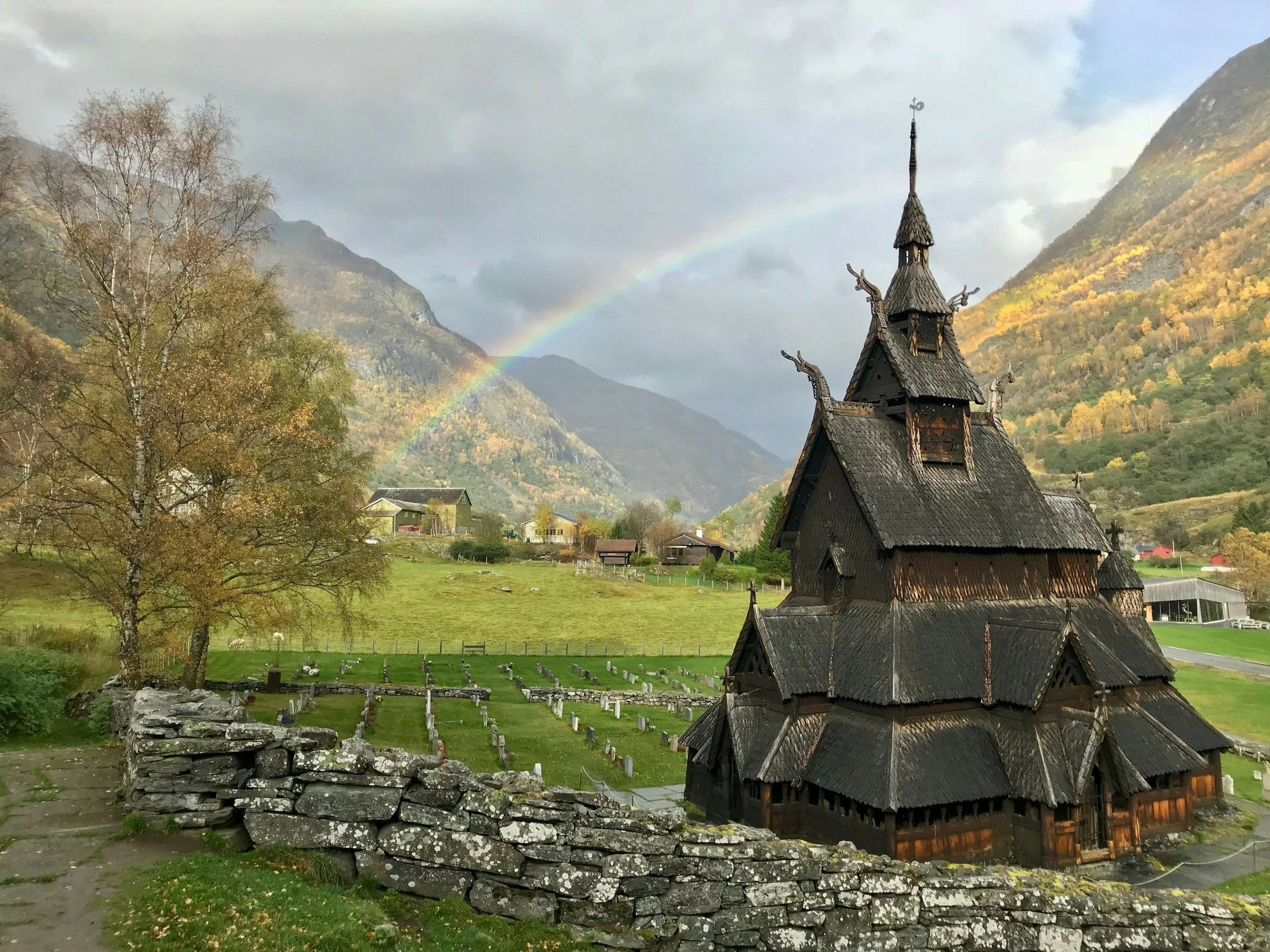
Discover Valdres, a mountain region in Eastern Norway shaped by summer farms, local food, stave churches and outdoor traditions. This complete guide covers the best places to visit, hikes, cycling routes, ski areas and distinctive places to stay.