
Tromsø, Senja and Lofoten Road Trip
Plan a road trip from Tromsø through Senja, Andøya and Vesterålen to Lofoten, following one of Northern Norway’s most spectacular coastal routes. This guide covers the best route, ferries, realistic driving times, where to stop, how long to allow and how the journey changes between summer and winter.
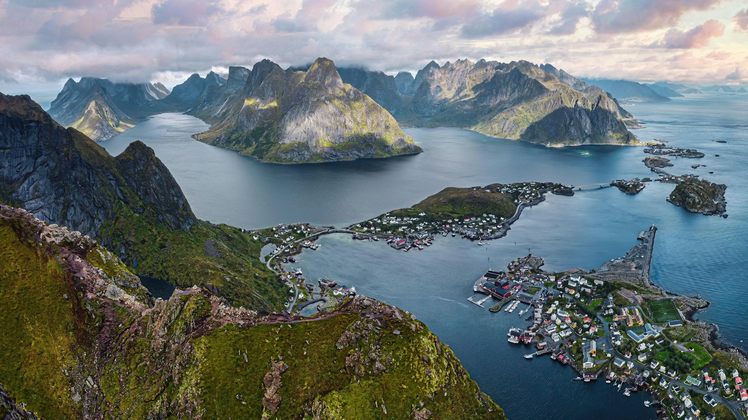
A road trip from Tromsø through Senja and Vesterålen to Lofoten is one of the most rewarding ways to experience Northern Norway. Rather than travelling directly between the region’s best-known destinations, the route takes you along exposed Arctic coastline, across fjords by ferry, through fishing communities and over several islands where the journey itself becomes as important as where you eventually stop.
The journey begins in Tromsø and follows the outer coast south through Senja, Andøya and Vesterålen before reaching Lofoten. Ferries connect several sections of the route, allowing you to remain close to the coast rather than repeatedly returning to the faster mainland roads.
It is also a route that is easy to underestimate. Tromsø, Senja and Lofoten may look reasonably close together on a map, but the roads follow mountains and fjords, ferries introduce waiting time, and many of the places worth stopping at sit away from the fastest route. I would not recommend trying to complete the full journey in less than 10 days, and 12–14 days gives the road trip considerably more room for hiking, weather changes, ferry logistics and time in the places you have travelled so far to see.
This guide is therefore not organised as Day 1, Day 2 and Day 3. Instead, it follows the road from Tromsø to Lofoten, looking at each stage of the journey, the stops that are genuinely worth making, realistic travel times and where it makes sense to slow down. The aim is to help you build the road trip around the time you have without turning Northern Norway into a race between destinations.
The Route at a Glance
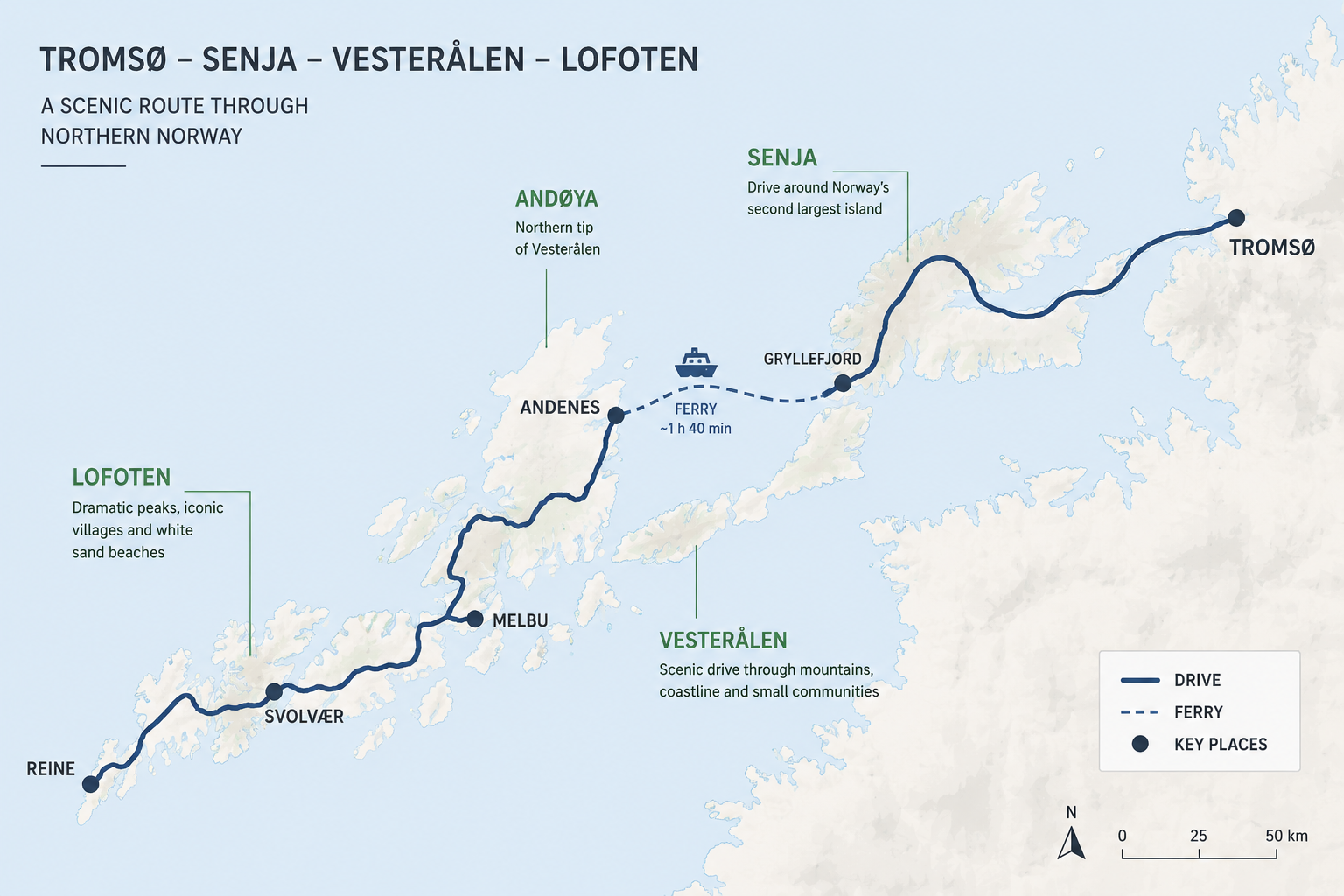
The road trip follows the outer coast of Northern Norway rather than the faster inland route along the E6. The basic journey is:
Tromsø → Kvaløya → Brensholmen → Botnhamn → Senja → Gryllefjord → Andenes → Andøya → Vesterålen → Lofoten
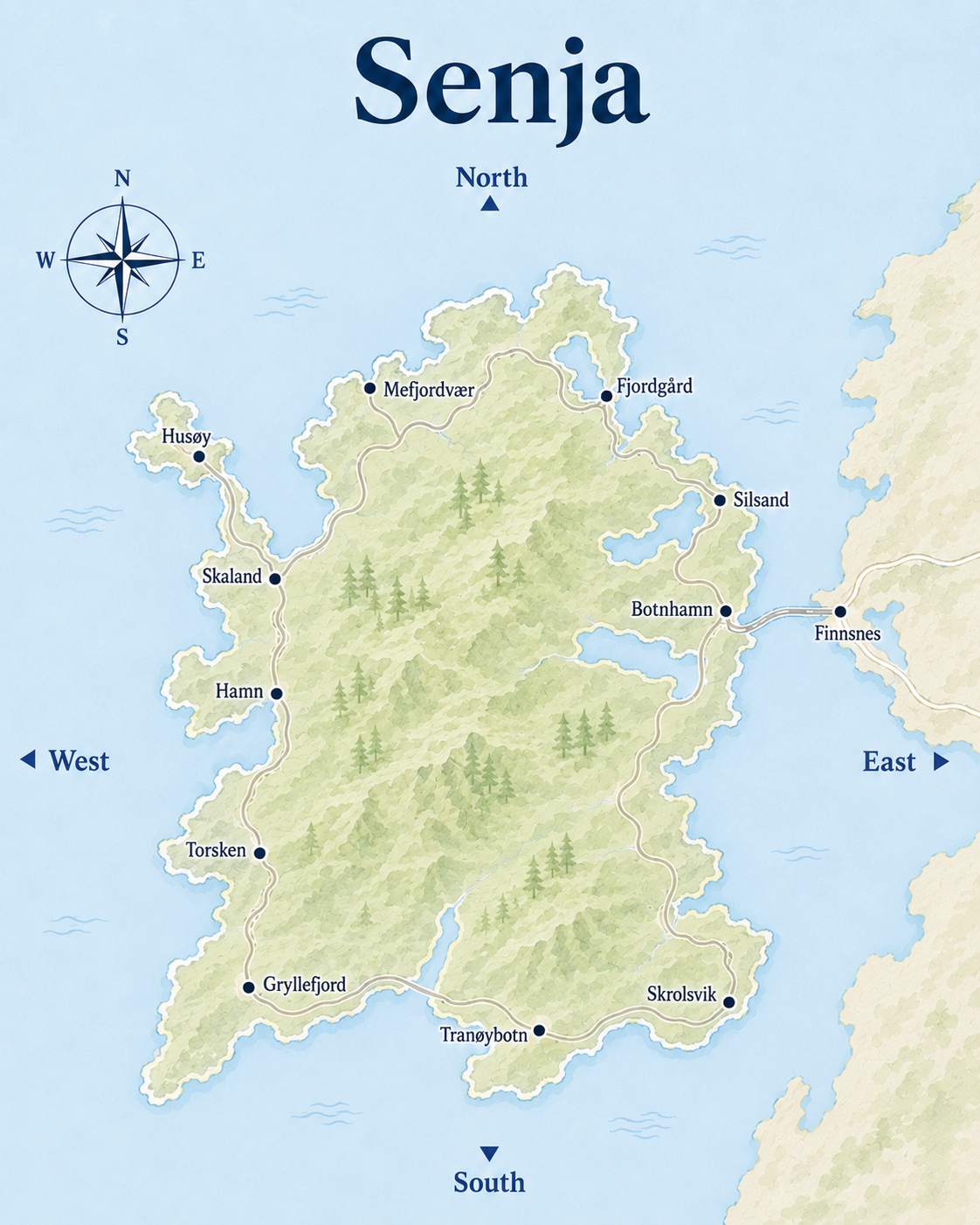
From Tromsø, you drive west across Kvaløya to Brensholmen before taking the ferry to Botnhamn on northern Senja. From there, Norwegian Scenic Route Senja runs for 102 kilometres along the outer coast to Gryllefjord, with detours towards places such as Husøy and Mefjordvær.
The seasonal Gryllefjord–Andenes ferry then carries you across Andfjorden to Andøya in Vesterålen. From Andenes, Norwegian Scenic Route Andøya follows the island’s exposed western coast before the road continues south through Vesterålen and eventually into Lofoten.
This means Senja and Andøya are not simply stops between Tromsø and Lofoten. Together, their Scenic Routes form an outer coastal alternative to travelling south along the mainland E6, which is one of the main reasons this particular road trip is so rewarding.
The route is simplest when travelled one way from Tromsø towards Lofoten, particularly while the Gryllefjord–Andenes ferry is operating. The Brensholmen–Botnhamn ferry operates year-round, while the connection between Gryllefjord and Andenes is seasonal.
When Can You Do This Road Trip?
You can travel between Tromsø, Senja, Vesterålen and Lofoten throughout the year, but the route changes significantly between summer and winter.
From approximately mid-May to late September, the seasonal Gryllefjord–Andenes ferry allows you to follow the outer coast almost continuously from Tromsø through Senja and Andøya to Lofoten. This is the version of the road trip described in this guide.
In winter, the Brensholmen–Botnhamn ferry still connects Kvaløya with Senja, and both Senja and Lofoten can be spectacular road-trip destinations. However, the Gryllefjord–Andenes ferry does not operate, so after exploring Senja you need to return via Finnsnes and the mainland road network before continuing towards Vesterålen and Lofoten.
Winter also changes the character of the journey completely. Snow, ice, limited daylight, storms and temporary road closures mean you should allow considerably more flexibility, and I would only recommend driving this route independently if you are comfortable with proper winter driving conditions.
June
June gives you almost continuous daylight and the midnight sun, which makes long days on the road much easier to manage. It is also generally quieter than July, although snow can remain on higher hiking routes and conditions vary from year to year.
July
July is the easiest month if you want the broadest range of hiking, ferries, boat trips and other summer activities operating at the same time. It is also the busiest period, so accommodation and popular ferry crossings require more planning.
August
August is one of the strongest choices for the route. Summer activities are still operating, hiking conditions are usually well established, and by later in the month darker evenings begin returning. This creates the possibility of combining a largely summer road trip with the first northern lights of the season.
September
September brings autumn colours, fewer visitors and properly dark nights, but the trade-off is more changeable weather and reduced seasonal services. The Gryllefjord–Andenes ferry normally continues until late September, but always check the current timetable before building the road trip around it.
Outside the ferry season, it is still possible to drive between Senja, Vesterålen and Lofoten, but you need to return to the mainland and travel via the inland road network. That changes both the route and the amount of driving considerably, so I would treat it as a different road trip rather than simply the winter version of this one.
Starting the Road Trip in Tromsø
Tromsø is a natural starting point for this road trip because of its airport connections and range of car-rental companies, while also being a destination worth spending some time in before heading south.
I would keep the Tromsø part of this particular journey relatively focused. The road trip becomes increasingly rural once you leave the city, so Tromsø is a good place to enjoy the things that become less available later: restaurants, museums, cafés and a more urban Arctic atmosphere.
If you are spending time in central Tromsø before beginning the road trip, you may not need to collect the rental car immediately after landing. Much of the city centre is walkable, and delaying the rental can save both parking costs and an unnecessary rental day. Collecting the car when you are ready to leave for Senja is often the more practical option.
For what to see, where to eat and how to spend your time in the city before setting off, see the Tromsø Travel Guide.
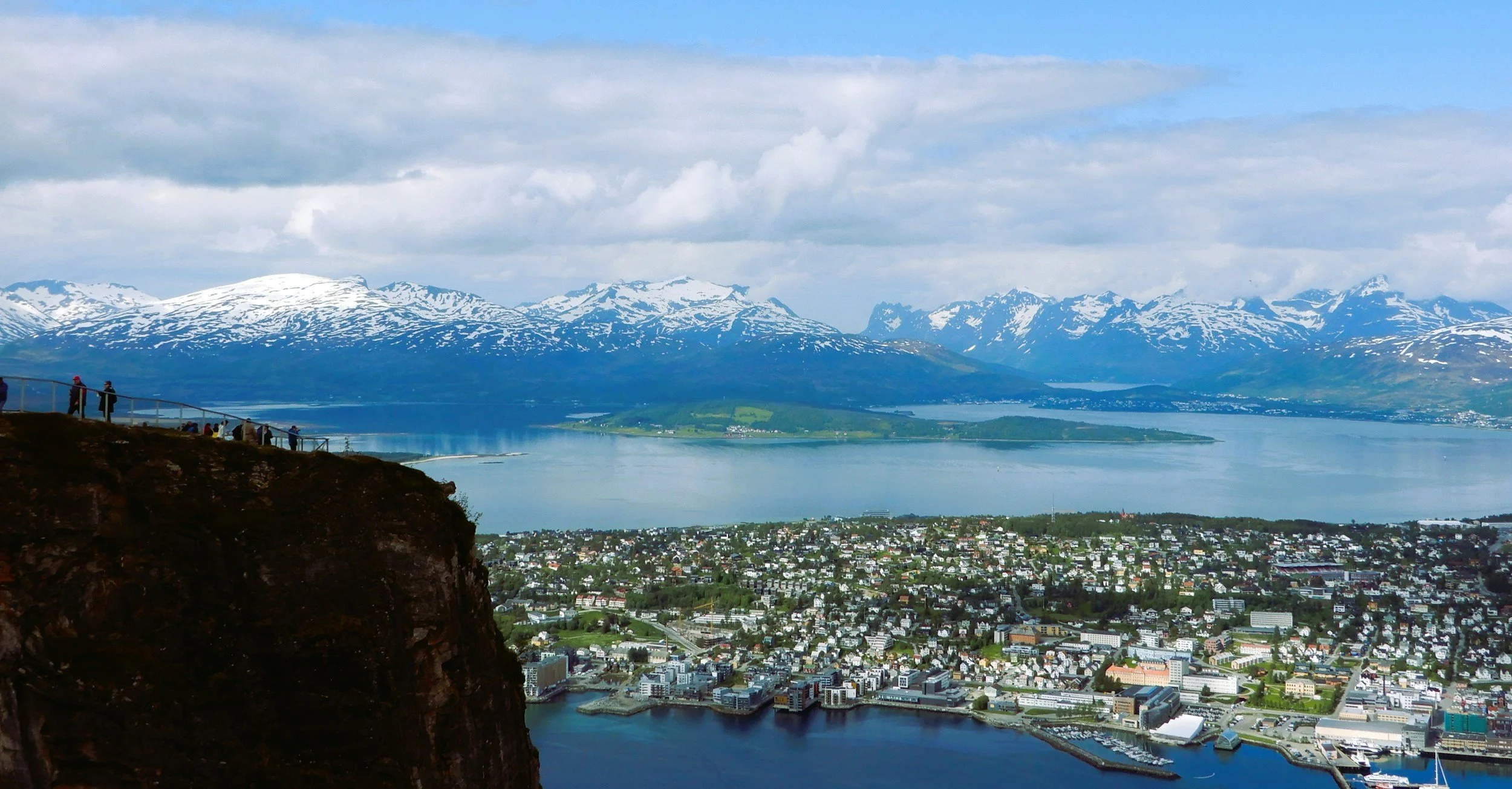
Tromsø to Senja: Across Kvaløya and the Brensholmen Ferry
The first leg from Tromsø to Senja is relatively short in distance, but this is where the road trip really begins. From central Tromsø, the drive to the ferry quay at Brensholmen is around 55 kilometres and takes approximately one hour without stops.
The city disappears quickly as you head west across Kvaløya. Open water replaces the urban shoreline, settlements become smaller and the mountains grow increasingly dominant around the road. By the time you approach Brensholmen, the journey already feels very different from Tromsø.
If you have plenty of time, this section can be extended with stops around Kvaløya or neighbouring Sommarøy, but you do not need to turn it into a full sightseeing day for the route itself to be worthwhile.
Brensholmen to Botnhamn
The car ferry from Brensholmen crosses to Botnhamn on northern Senja in approximately 45 minutes and operates year-round. You cannot simply add the one-hour drive and the crossing time together and assume Tromsø to Senja will take less than two hours, however. You also need to account for arriving before departure, loading and whatever gap there is between your arrival and the next sailing.
For planning purposes, I would allow around 2.5–3 hours from Tromsø to Botnhamn even if you are travelling directly and not making sightseeing stops on Kvaløya. Check the current ferry timetable before leaving Tromsø and build the rest of the day around the sailing rather than trying to reach the quay at the last possible moment.
Once the ferry arrives at Botnhamn, you are already on northern Senja and can continue directly towards places such as Husøy, Fjordgård and Mefjordvær or begin following the Norwegian Scenic Route west. If you take an earlier ferry, there is plenty of scope to start exploring Senja the same day, but I would avoid attaching an important weather-dependent hike to a tightly timed ferry journey.
Within only a few hours, you have moved from Northern Norway’s largest city into a landscape where narrow coastal roads, small communities and steep mountains begin determining the rhythm of the journey.
Driving Across Senja
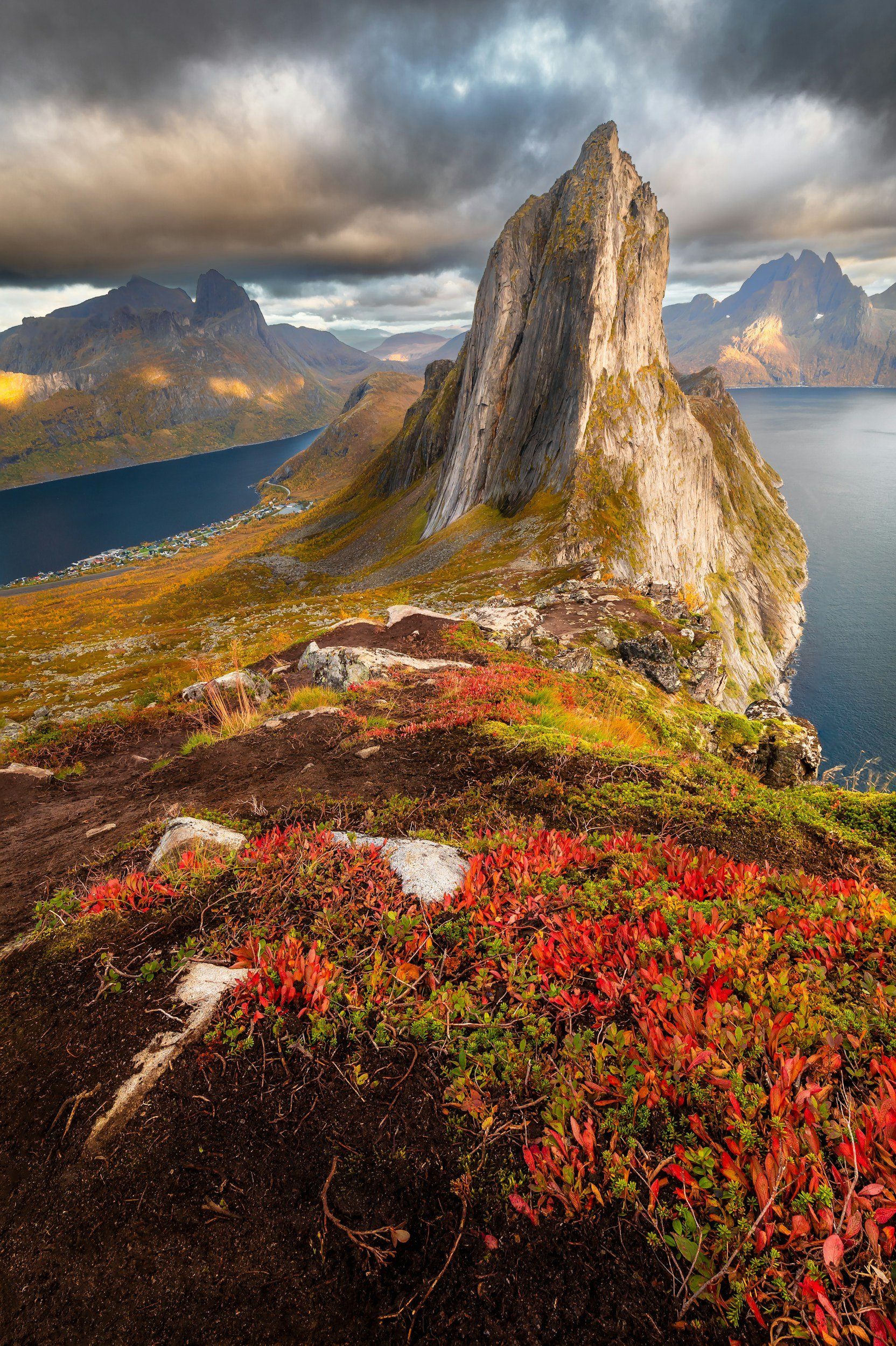
Once you arrive at Botnhamn, the road trip enters one of its strongest sections. Norwegian Scenic Route Senja runs for 102 kilometres between Botnhamn and Gryllefjord, following the island’s outer coast through fjords, beaches, mountain passes and small communities.
The distance sounds short, but this is not a road you should think about in terms of how quickly you can complete it. Once you include the Scenic Route, viewpoints, detours and any hiking or activities, Senja becomes a destination rather than a transfer.
Botnhamn to Mefjordvær and Fjordgård
From Botnhamn, the route begins by following northern Senja towards some of the island’s most dramatic mountain landscapes. Short detours lead towards Husøy and Mefjordvær, while Fjordgård sits beneath Hesten and Segla further along the northern coast.
If you want to hike Hesten or spend time around Fjordgård, build that into the Senja portion of the road trip rather than trying to add it casually between ferry crossings. A hike can easily take up much of a day once weather, parking and time on the mountain are included.
Tungeneset and Ersfjordstranda
Continuing west, Tungeneset is one of the essential Scenic Route stops. A wooden walkway leads across the rocky headland towards the sea, with the sharp Okshornan peaks rising across the fjord.
A short drive further on brings you to Ersfjordstranda, a white Arctic beach surrounded by steep mountains. Both stops are easy to reach directly from the road, but they are places where the advantage of allowing extra time becomes obvious. Even without hiking, it is easy to spend far longer here than a navigation app would suggest.
Bergsbotn and the Western Coast
At Bergsbotn, a 44-metre viewing platform extends above Bergsfjord and gives you one of the best elevated views on the route without requiring a hike. From here, the road continues through a noticeably different landscape of fjords, islands and skerries towards the western side of Senja.
Bøvær, Hamn and the wider Bergsfjorden area are worth slowing down for, particularly if you want to add kayaking, a boat trip or simply spend some time beside the coast rather than moving continuously between viewpoints.
Do Not Treat Senja as a One-Day Transfer
You can physically travel from Botnhamn to Gryllefjord in a day, but I would not recommend using Senja purely as the road between the two ferries. The island has enough hiking, wildlife, sea activities and coastal landscapes to justify several days, and the road trip is much better when the Scenic Route becomes part of the stay rather than a checklist completed on the way south.
The Senja Travel Guide goes into the island’s hikes, wildlife, food, accommodation and activities in much more detail. For this road trip, the important thing is to leave Senja with enough time to reach Gryllefjord without making the ferry to Andenes dictate every hour of your stay.
Senja to Andøya: The Gryllefjord–Andenes Ferry
The ferry from Gryllefjord to Andenes is the key connection that turns this road trip into a continuous coastal journey. Instead of leaving Senja by road and returning to the mainland, you cross Andfjorden directly to Andøya in Vesterålen and continue south from there.
The crossing takes around 1 hour 40 minutes and operates seasonally from roughly mid-May to late September, usually with a limited number of departures each day. Vehicle spaces cannot be reserved in advance.
Do Not Plan This Ferry Too Tightly
This is one of the places where a realistic road-trip plan matters most. During quieter parts of the season, arriving well ahead of departure may be enough. In high summer, however, queues can become much longer, and travellers may have to wait through one or more departures, particularly from Gryllefjord.
I would therefore avoid building a tightly scheduled day around a particular sailing. If you are travelling in July or another busy period, reach Gryllefjord with plenty of margin and treat the waiting time as part of the journey rather than something that can be eliminated with precise timing.
Arriving in Andenes
The ferry arrives at Andenes on the northern tip of Andøya, which is part of Vesterålen, not Lofoten. This distinction matters because you still have a substantial stretch of road trip ahead before reaching Lofoten.
Rather than leaving the ferry and immediately driving south as quickly as possible, use Andøya as the next part of the journey. The island has its own dramatic coastline, beaches, wildlife and Scenic Route, and it makes much more sense to experience some of it before continuing through Vesterålen.
The ferry is therefore not simply a transfer between Senja and “Lofoten”. It is the point where the road trip moves from one distinctive island landscape into another.
Don’t Rush Through Andøya
Arriving in Andenes marks the beginning of the next Scenic Route, not the end of the journey between Senja and Lofoten. Norwegian Scenic Route Andøya runs for 58 kilometres along the island’s exposed western coast between Andenes and Bjørnskinn, with open sea on one side and steep mountains rising close to the road on the other.
This is one of the easiest parts of the road trip to underestimate because 58 kilometres sounds like almost nothing. In reality, Andøya is worth slowing down for.
Andenes
Andenes is the main settlement at the northern tip of the island and a natural place to pause after the ferry. It is also one of Northern Norway’s best-known whale-watching bases, with trips heading towards the deep waters offshore where sperm whales are among the species regularly encountered.
If whale watching is part of your trip, this is one of the strongest places to consider adding it. Whale Watching in Norway explains the different seasons, species and whale-watching areas around the Norwegian coast in more detail.
If you are not going whale watching, Andenes still works well as a place to stop for food, supplies or an overnight stay before continuing down the western coast.
Bleik
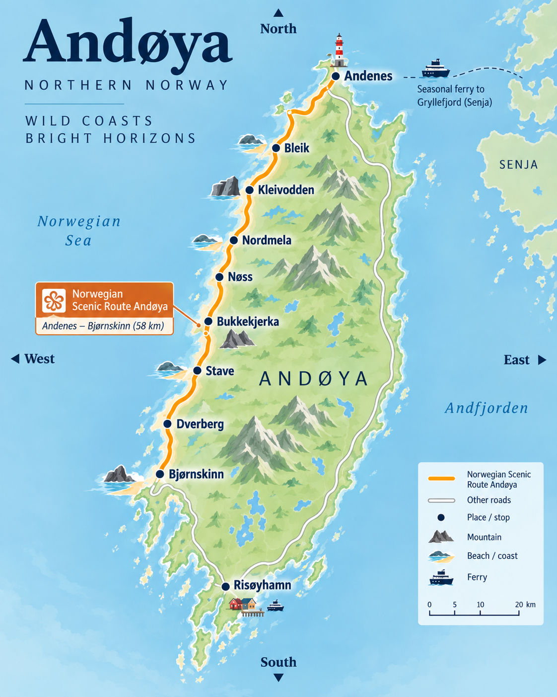
South of Andenes, Bleik is one of the most distinctive stops on Andøya. The fishing village sits beside a long white beach with Bleiksøya rising offshore, while the mountains immediately behind the village create one of the island’s most recognisable coastal landscapes.
Bleik is worth more than a quick photograph. Walk along the beach, spend some time in the village or simply stop long enough to appreciate how open this side of Andøya feels compared with the narrow fjords of Senja. Puffin safaris also operate from Bleik during the summer season.
Kleivodden and Bukkekjerka
The Scenic Route includes several deliberately designed stops along the coast. Kleivodden, just north of Bleik, looks across the open sea and surrounding mountains, while Bukkekjerka further south combines a dramatic coastal rock formation with one of the route’s architectural rest areas.
Neither requires a long visit, but together they are good examples of why Andøya should not be treated as a road you simply drive through on the way to Lofoten.
Check for Andøya Spaceport Road Closures
Andøya Spaceport lies beside the Scenic Route at Børvågen. During launch operations, the road can occasionally close for several hours, which matters if you are travelling through Andøya on a fixed schedule.
Check current road information before setting out, particularly if you need to reach a ferry, accommodation or another time-sensitive connection later in the day.
The route continues south past beaches, small settlements and open coastal landscape before reaching Bjørnskinn and joining the roads through the rest of Vesterålen. I would allow at least several hours for Andøya even without a major activity, and considerably longer if you want to add whale watching, hiking or time at the beaches.
The point is not to turn Andøya into another multi-day destination unless you want to. It is simply to recognise that the road between the ferry at Andenes and the rest of Vesterålen is one of the road trip’s strongest sections in its own right.
Through Vesterålen to Lofoten
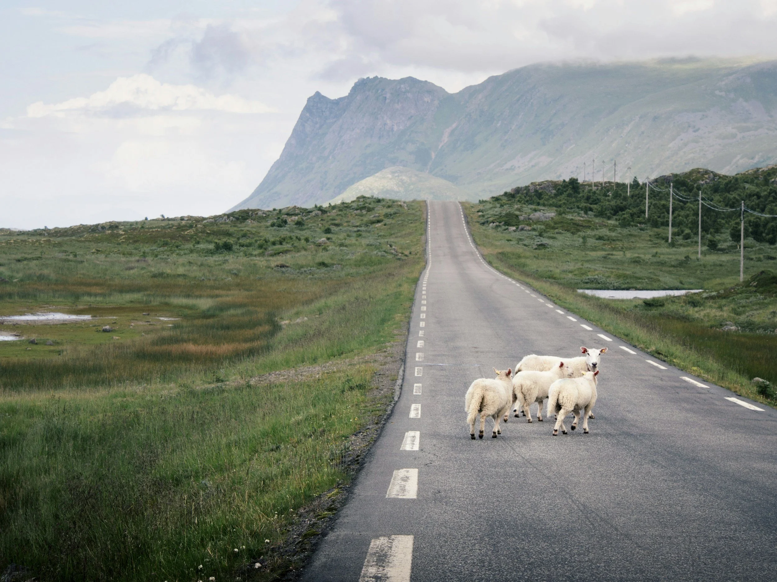
Once you leave Andøya, the road trip continues through Vesterålen before reaching Lofoten. This section is often treated as little more than a transfer, but it is worth allowing enough time to experience at least part of the landscape rather than simply aiming for the E10 as quickly as possible.
From the southern end of Andøya, the route continues towards Sortland and the central islands of Vesterålen. The landscape becomes less exposed than Andøya’s western coast, with broader fjords, lower mountains and larger settlements appearing along the way.
Sortland and Stokmarknes
Sortland is the main service centre in Vesterålen and a useful place to stop for fuel, groceries or a meal. Stokmarknes, on neighbouring Hadseløya, is more interesting if you want to add a cultural stop, particularly because of its close connection with the history of Hurtigruten.
You do not need to spend a full day in either town for this road trip, but stopping somewhere in central Vesterålen helps break up the journey between Andøya and Lofoten and prevents this entire section from becoming one long drive.
Choosing the Route Into Lofoten
There are two natural ways to continue from Vesterålen into Lofoten.
The simplest option is to remain on the road network and follow the E10 towards Lofoten, which avoids another ferry and is the more straightforward choice if you simply want to continue south.
If you have already chosen to travel through Stokmarknes and Hadseløya, another option is to continue to Melbu and take the ferry to Fiskebøl in Lofoten. This can fit naturally into a route through central Vesterålen and gives you another short sea crossing before entering the archipelago.
Neither route is universally better. The E10 is simpler and more direct, while Melbu–Fiskebøl makes more sense if Stokmarknes and Hadseløya are already part of your journey.
Once you enter Lofoten, the landscape changes again as sharper mountain ridges begin rising directly beside the road.
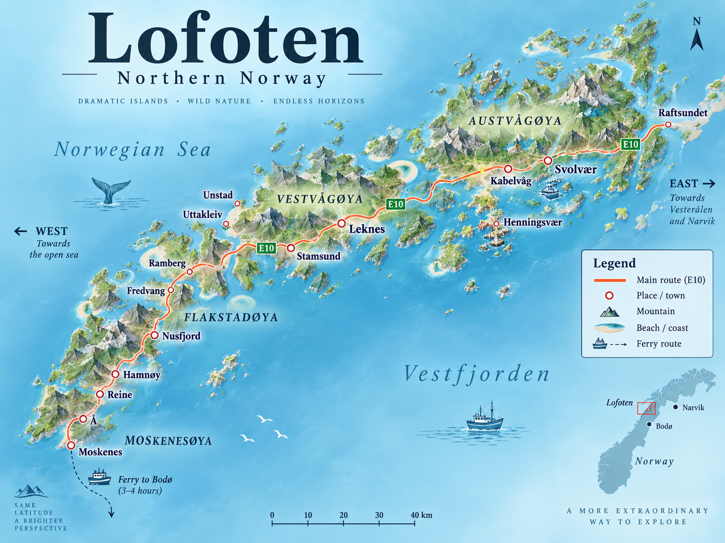
Norwegian Scenic Route Lofoten officially runs for 230 kilometres between Raftsundet and Å, with detours to places including Henningsvær, Eggum, Unstad, Utakleiv, Vikten and Nusfjord. Entering Lofoten is therefore not the end of the road trip but the beginning of its final major section.
I would avoid trying to combine Andøya, central Vesterålen and a large section of Lofoten into the same day. Even if the pure driving time looks manageable, short stops, ferries and scenery quickly turn a few hours on the map into most of a day.
Driving Through Lofoten
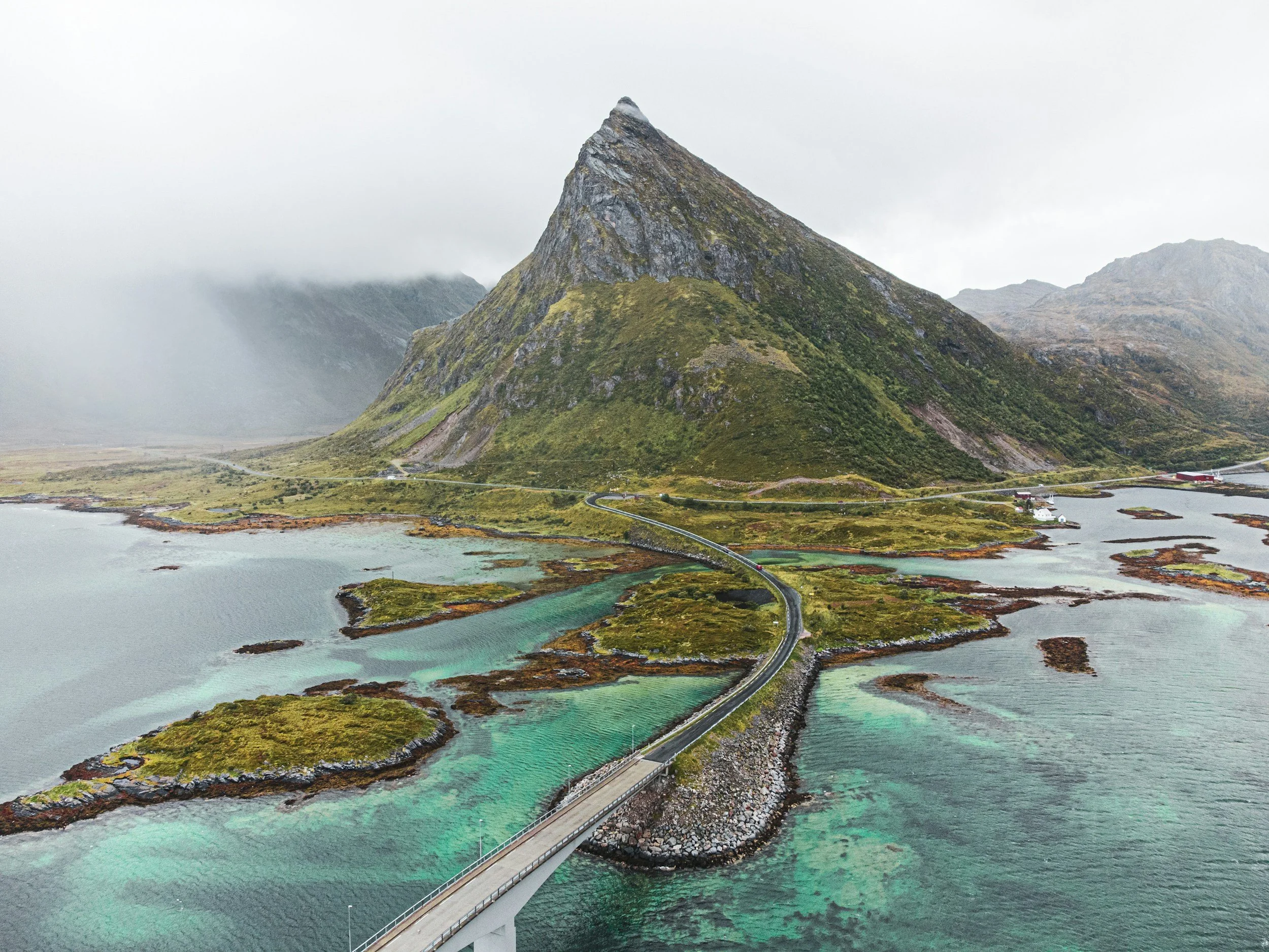
Once you enter Lofoten, the road trip becomes much more concentrated. The E10 forms the main spine of the archipelago, but many of the places worth visiting sit on short detours from it, so progress is usually much slower than the distance suggests.
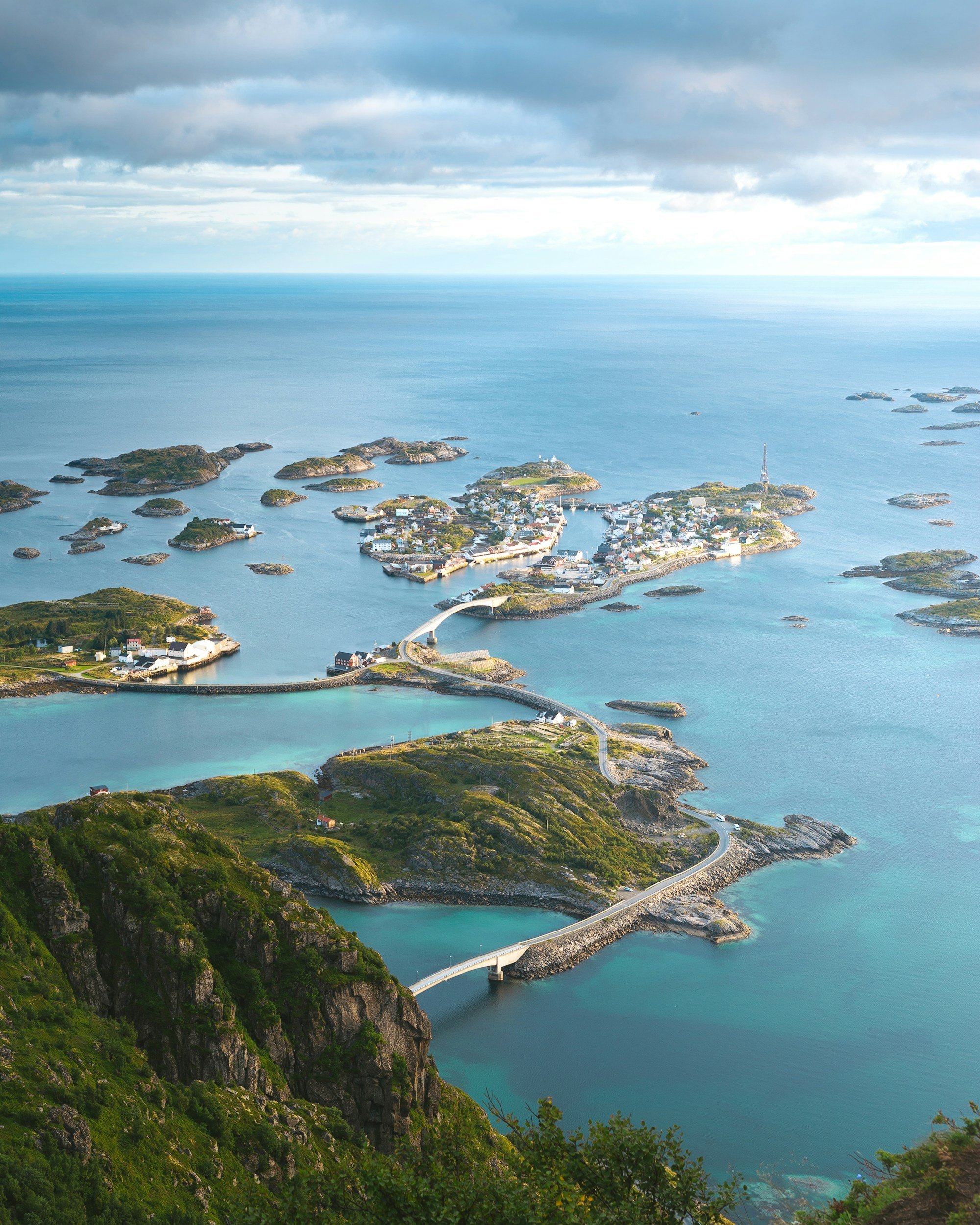
The natural direction is west, beginning around Svolvær and Kabelvåg before continuing through Vestvågøy and towards the increasingly dramatic landscapes of Flakstadøya and Moskenesøya.
Svolvær, Kabelvåg and Henningsvær
Svolvær is the largest town in Lofoten and a practical place to begin this section of the road trip. Nearby Kabelvåg provides a quieter contrast, while Henningsvær requires a detour from the E10 but is one of the places I would make time for rather than simply passing through.
You do not need to stay in all three. They sit close enough together that one base can work well while you explore the eastern part of Lofoten.
Through Vestvågøy
Continuing west brings you onto Vestvågøy, where the landscape opens into broader farmland, beaches and lower valleys between the mountains. This part of Lofoten feels noticeably different from both the eastern islands and the sharper peaks further west.
Detours towards places such as Eggum and Unstad are worth considering if you have the time, but this is also where it becomes important not to turn every road off the E10 into another item on a checklist.
Flakstadøya and Moskenesøya
The western part of Lofoten contains many of the landscapes that have made the archipelago famous. Ramberg, Fredvang and the surrounding beaches lead towards increasingly steep mountains before the road reaches Hamnøy, Reine and finally Å.
This is the part of Lofoten where I would slow the journey down most. Distances between villages are short, but hikes, beaches, viewpoints and changing weather can easily fill several days.
Rather than changing accommodation every night as you move west, it usually makes more sense to use two bases across Lofoten and explore the surrounding areas from each. One around Svolvær or Henningsvær works well for the eastern islands, while somewhere around Ramberg, Reine or Hamnøy gives you much easier access to the western end.
The Lofoten Travel Guide covers the individual villages, hikes, beaches, activities and places to stay in much more detail. For this road trip, the important thing is to resist treating the E10 as a road that simply needs to be followed to Å. Lofoten is the final major destination of the journey, and it deserves enough time to stop feeling like the last leg of a drive south.
Where Should the Road Trip End?
The most natural place to finish this road trip is in Lofoten rather than driving all the way back to Tromsø. By this point you have already travelled south through Senja, Andøya and Vesterålen, so returning to Tromsø adds a substantial amount of driving and turns an otherwise linear journey into a long loop.
If your flights and rental-car arrangements allow it, a one-way trip is the cleaner option.
Check the one-way rental conditions before booking the rest of the journey, however. Not every rental company allows the same drop-off locations, and one-way fees can vary considerably. It is worth confirming where the car can actually be returned before committing to flights and accommodation at the end of the route.
Flying from Lofoten
Lofoten has airports at Svolvær and Leknes, both of which can be useful if you want to finish the road trip within the archipelago. Which one makes more sense depends on where you spend your final nights and where your onward flights connect.
This can be particularly convenient if you want to end the trip around Reine, Ramberg or the western islands and then work your way back only as far as Leknes rather than retracing the entire route.
Ending at Evenes
Another practical option is to drive from Lofoten to Harstad/Narvik Airport, Evenes. Evenes has more flight connections than the smaller Lofoten airports and may also be easier for some one-way car-rental arrangements.
The downside is that it adds another driving leg after you have effectively finished exploring Lofoten, so I would only choose it if the flight schedule, rental arrangement or onward journey makes it worthwhile.
Returning to Tromsø
You can return to Tromsø, but I would not build the road trip around that unless you have a specific reason to do so. The return journey is long and takes you back through mainland Northern Norway rather than retracing the scenic coastal route in reverse.
If you do need to return the car in Tromsø, allow an additional travel day rather than treating the drive north as something you can casually add after your final day in Lofoten.
For this route, the ideal setup is therefore Tromsø in, Lofoten or Evenes out whenever the flights and rental-car costs make that practical. It keeps the journey moving in one direction instead of ending the trip with a long drive back to where you started.
Driving Times You Should Actually Plan For
One of the easiest mistakes to make on this road trip is planning around the driving time shown on a map. Those times assume that you drive directly from one point to another without ferry queues, viewpoints, narrow roads, hikes, meals or the stops that make the route worth taking in the first place.
Tromsø to Brensholmen
From Tromsø to Brensholmen, the pure driving time is around one hour. In reality, I would allow closer to 1–1.5 hours before the ferry simply to give yourself enough margin and avoid turning the first leg of the road trip into a race against the timetable.
Tromsø to Botnhamn
From Tromsø to Botnhamn on Senja, the journey is roughly one hour of driving plus the ferry crossing. Once you include waiting, boarding and the crossing itself, around 2.5–3 hours is a much more realistic amount of time to allow.
Across Senja
The direct drive between Botnhamn and Gryllefjord looks short on a map, but that figure is largely irrelevant for this road trip. Once you follow the Scenic Route, make detours and actually explore the island, Senja should be measured in days rather than driving hours.
Gryllefjord to Andenes
The ferry crossing itself takes around 1 hour 40 minutes, but you need to leave considerably more room around it. In high summer, queues can turn the crossing into a much larger part of the day than the published sailing time suggests.
Andenes to Svolvær
The direct drive from Andenes to Svolvær takes a little over three hours. If you follow Andøya’s Scenic Route, stop in Vesterålen and actually experience the coast, it is much better treated as a full travel day rather than a simple transfer.
Svolvær to Reine
Svolvær to Reine takes roughly two hours if you drive directly, but that is not how most people experience this part of Lofoten.
Once you include detours to villages, beaches and viewpoints, or places such as Henningsvær, Ramberg and Unstad, the journey can easily fill most of a day.
This is why I would plan the road trip around sections of the coast rather than kilometres per day. A three-hour driving day in Northern Norway can easily become a full day once you actually experience the places along the route.
For a broader explanation of why road-trip distances in Norway are so easy to underestimate, see Driving Distances in Norway: What Visitors Often Underestimate.
Practical Things to Know Before Driving the Route
This road trip is straightforward to drive in good summer conditions, but a few practical details make a substantial difference once you begin moving between islands and smaller coastal communities.
Book Accommodation Early (in Summer)
July and early August are the busiest periods along much of the route, particularly in Senja and Lofoten. Accommodation in smaller communities is limited, so leaving every night completely open can make the road trip unnecessarily difficult.
You do not need to plan every meal or activity months in advance, but I would secure the places you particularly want to stay and leave flexibility within the days themselves.
Fuel and EV Charging
Fuel stations and EV chargers are available throughout the route, but they become less frequent once you leave the larger towns. Tromsø, Finnsnes, Sortland, Svolvær and Leknes are useful places to take care of fuel, charging and supplies before continuing into smaller communities.
If you are driving an electric car, plan charging around the route rather than assuming the next village will have the charger you need. Norway has extensive EV infrastructure, but remote coastal driving still benefits from a little forward planning.
Expect Narrow Roads
Some of the most scenic sections of Senja, Andøya and Lofoten are also narrow. Roads pass through tunnels, follow steep coastlines and occasionally narrow enough that drivers need to use passing places.
Drive according to the road and conditions rather than assuming the speed limit represents the speed you should maintain.
For Norwegian road rules, tolls, ferries, tunnels and other practical information, see Driving in Norway: Everything You Need to Know.
Parking Can Be the Hardest Part of Popular Stops
The road itself is rarely the main problem in summer. Parking around popular trailheads, beaches and villages can be considerably more frustrating, particularly in Lofoten.
Use designated parking areas and avoid leaving the car on narrow road shoulders, private land or anywhere that blocks access for residents and emergency vehicles. Arriving earlier or later in the day can make popular stops much easier.
Let the Weather Change Your Plans
Northern Norway’s weather can vary significantly over relatively short distances. A mountain hike may be covered in cloud while conditions remain perfectly suitable for a beach, museum or scenic drive elsewhere along the route.
This is one of the strongest arguments for allowing more than the absolute minimum time. Keep some activities movable rather than assigning every hike and boat trip to an immovable date.
If You Are Travelling by Campervan
A campervan works well for this route, but it does not mean you can stop overnight wherever there is an attractive view. Parking, camping and access to private or cultivated land are separate issues, and local restrictions should always be respected.
The Norwegian Right to Roam Explainedcovers allemannsretten, wild camping and the rules around accessing nature in Norway in more detail.
The most useful approach throughout the journey is to plan the major logistics while leaving enough room for the road trip itself to change. Weather, ferry queues and places you had not expected to stop will inevitably alter some days, and the route works much better when that flexibility is built in from the beginning.
Final Words
Tromsø, Senja and Lofoten are each strong enough to justify a journey on their own, but what makes this road trip particularly special is the landscape that connects them. Crossing Kvaløya, driving Senja’s outer coast, taking the ferry across Andfjorden and following Andøya and Vesterålen south means you experience far more of Northern Norway than you would by simply flying between its best-known destinations.
The route also becomes better the less you treat it as something to complete. Senja deserves more than a drive between two ferries, Andøya is worth stopping for before continuing south, and Lofoten needs enough time to become a destination rather than simply the final point on the map.
If you have the time, I would choose this coastal route over the faster journey between Tromsø and Lofoten. The point is not simply to reach Lofoten by the most scenic possible road, but to experience the chain of islands, fjords and coastal communities that lies between the two. On this journey, the road is not the space between the destinations. It is one of the destinations.
More articles about Norway:
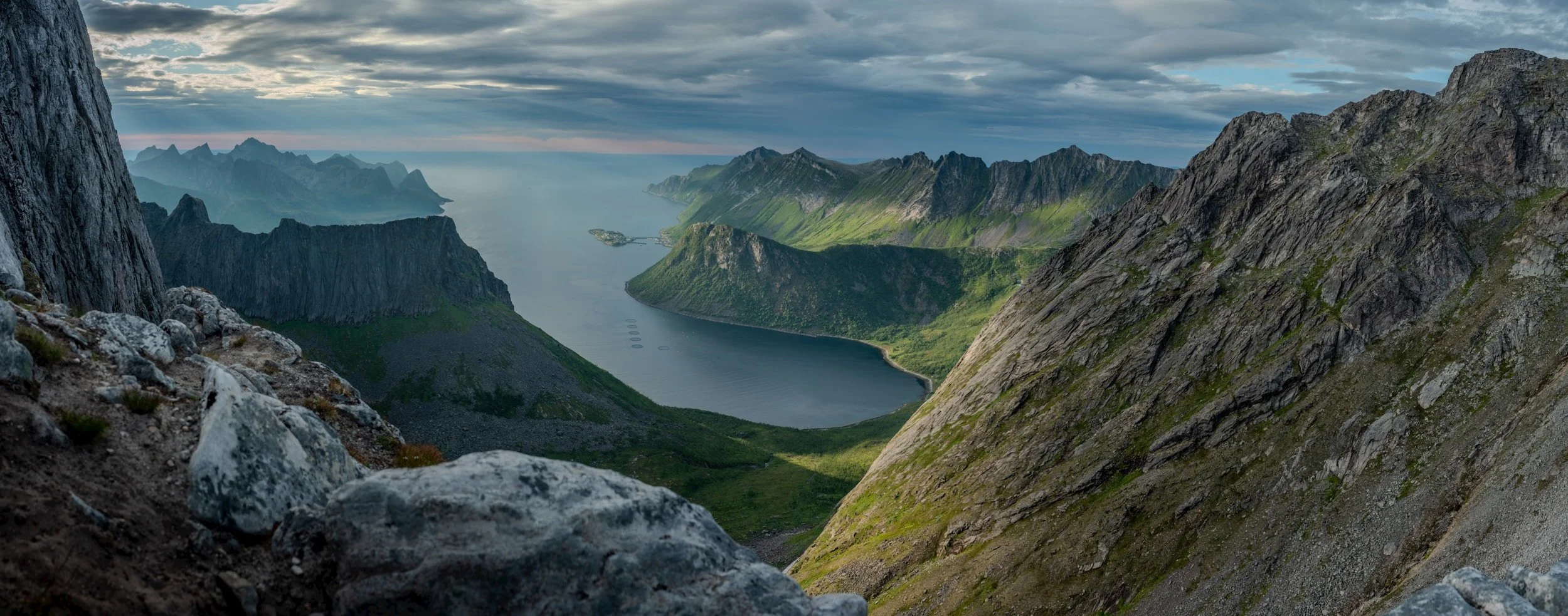

Explore Senja beyond its famous mountain views, from whale watching, hiking and Arctic wildlife to fishing, local culture, scenic roads and winter adventures. This guide covers what to do, where to stay and eat, when to visit and how to travel around one of Northern Norway’s most varied islands.