Driving Distances in Norway: What Visitors Often Underestimate
Norway can appear straightforward to navigate when viewed on a map. Distances between destinations are rarely extreme, and routes may initially seem manageable within a single day.
In practice, travel typically takes longer than many visitors anticipate.
Road infrastructure follows the natural landscape rather than imposing direct lines across it. Fjords interrupt routes, mountain terrain reduces average speeds, and ferry crossings remain an integrated part of the transport network.
Recognising these structural factors early allows for more realistic planning and a significantly more comfortable journey.
This article forms part of the wider Norway travel guide, which brings together practical resources on planning, seasonal travel and logistics across the country.
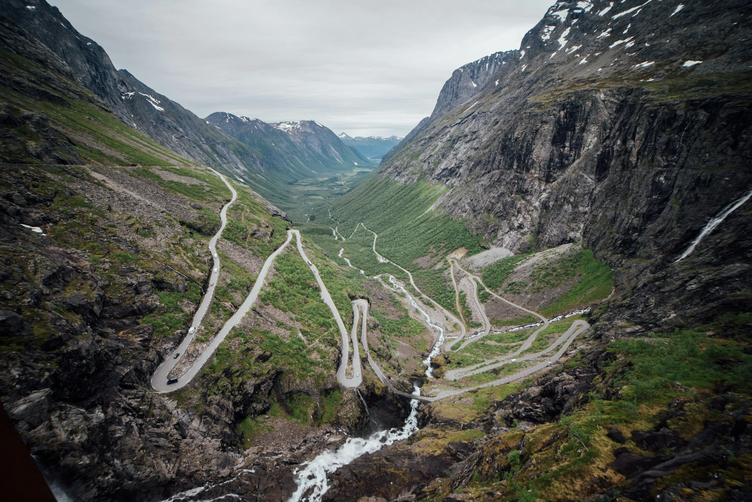
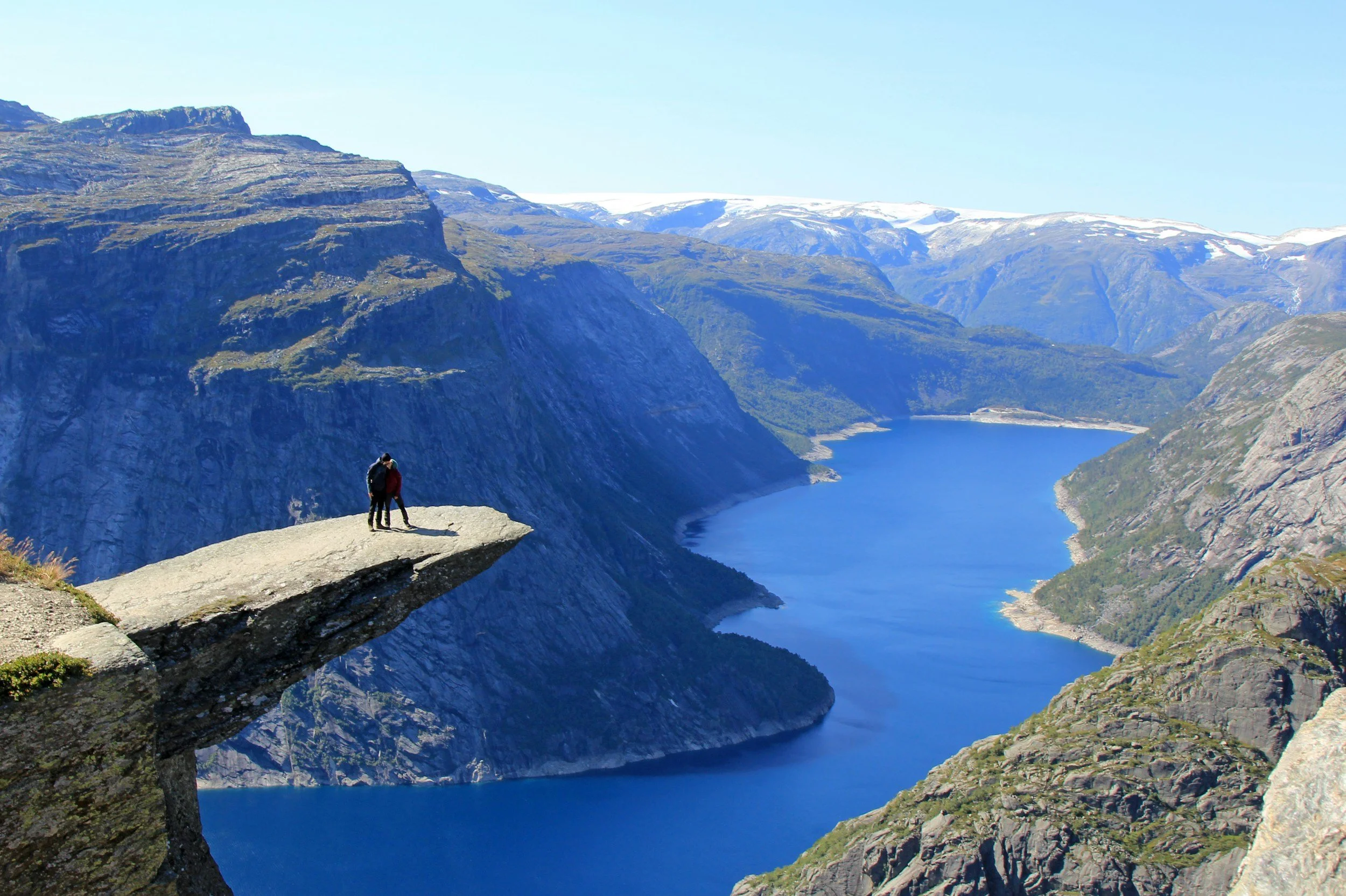
At Trollstigen, the map tells only part of the story. Mountain roads rarely follow straight lines, and travel time is often longer than expected.
Why Do Driving Distances in Norway Take Longer Than Expected?
“Driving times in Norway are influenced by terrain, road design, ferry crossings and changing weather conditions. As a result, journeys often take longer than map estimates suggest, even when distances appear modest.”
Road Infrastructure and Travel Speed
Norwegian infrastructure prioritises safety, environmental adaptation and long-term durability over high-speed transit.
Travellers should expect:
limited motorway networks
narrower rural roads
frequent elevation changes
tunnels and bridges
ferry connections
Average speeds are therefore typically lower than in much of continental Europe.
A distance of 300 kilometres should not automatically be interpreted as a routine day of driving.
In Norway, travel time is shaped more by landscape than by distance.
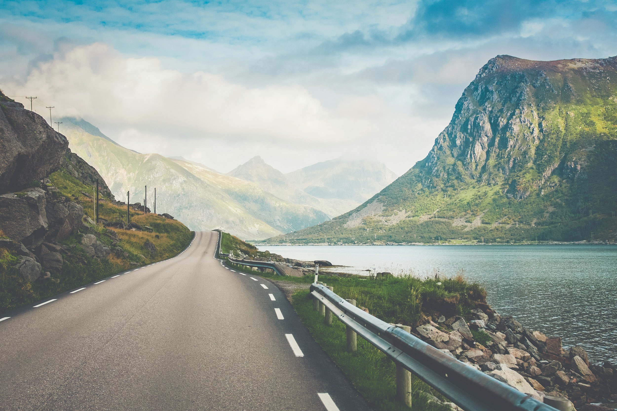
Across coastal Norway, roads are shaped by the surrounding landscape, a defining factor in realistic travel planning.
Map Distance vs Typical Travel Time
| Distance on Map | Common Assumption | Typical Travel Time |
|---|---|---|
| 100 km | ~1–1.5 hours | Often 2–3 hours |
| 250 km | Half a day | Frequently most of the day |
| 400 km | A long drive | Often impractical in one day |
| Fjord crossings | Bridge or tunnel | Often ferry-dependent |
| Mountain routes | Stable conditions | Weather-sensitive |
Map distance alone rarely communicates the full demands of a route.
Geography as a Structural Constraint
Norway’s geography directly shapes travel patterns.
Fjords prevent linear routing. Mountain terrain necessitates slower roads. Coastal systems introduce weather variability throughout the year.
These are not disruptions; they are defining characteristics of travelling in Norway.
Planning becomes significantly easier once they are treated as constants rather than exceptions.
Ferries Within the Road Network
Ferries function as extensions of the road system rather than occasional interruptions.
While typically reliable, they introduce timing considerations such as:
departure schedules
seasonal frequency
weather sensitivity
Allowing margin for crossings helps prevent unnecessary schedule pressure.
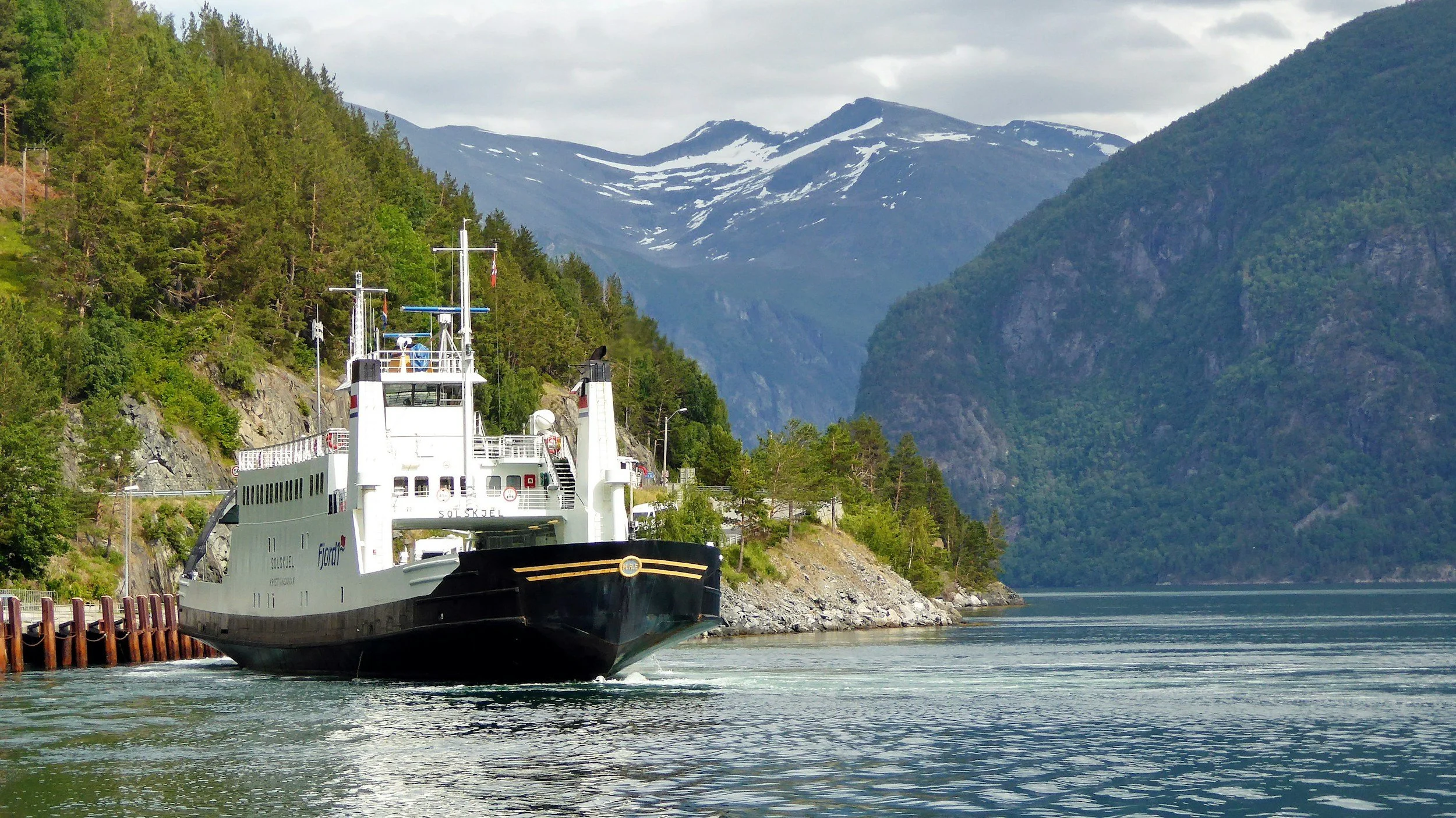
Ferry crossings form an integrated part of Norway’s road infrastructure and should be factored into realistic driving schedules.
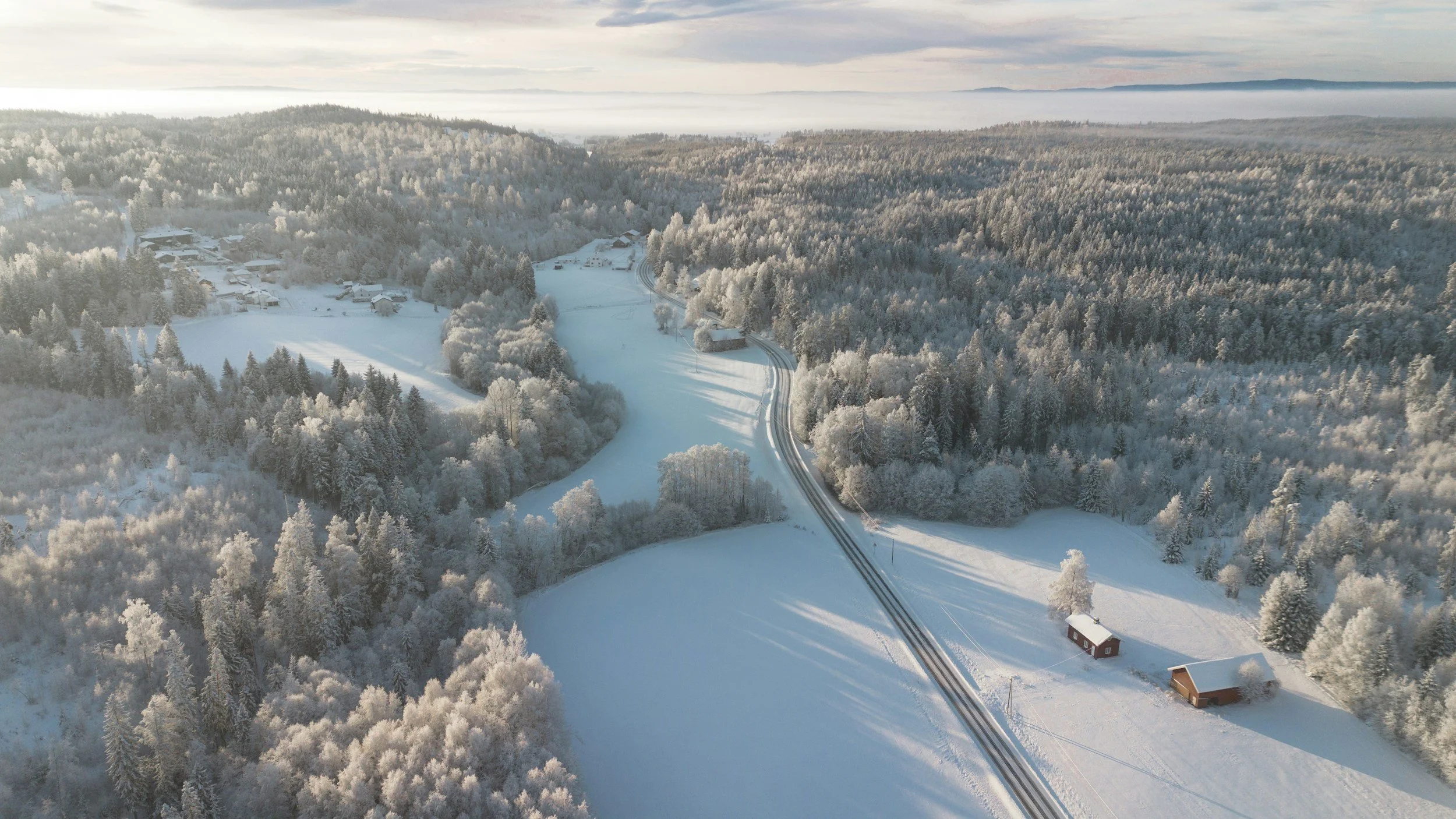
Seasonal Conditions Influence Travel
Seasonality is not a minor planning detail in Norway; it is a structural factor.
Winter introduces reduced daylight and more demanding driving conditions, while summer traffic can extend journey times in popular regions.
Travellers visiting outside peak summer should review Driving in Norway in Winter, which outlines legal requirements, tyre categories and safety considerations.
For a broader overview of regional winter conditions, see Winter Travel in Norway: Where to Go and What to Expect.
Seasonal conditions affect how far you can travel in a day and how journeys should be planned.
How Far Should You Drive Per Day in Norway?
“For most travellers, 150–250 kilometres represents a comfortable daily range. This allows time for crossings, rest stops and variable conditions without turning the day into prolonged transit.”
Recommended Daily Driving Distances
| Travel Style | Comfortable Range |
|---|---|
| Scenic travel | 150–200 km |
| Moderate pace | 200–250 km |
| Transit-focused days | Up to 300 km (occasionally) |
| Winter travel | Often less |
Consistently exceeding these ranges often results in fatigue and a compressed travel experience.
Driver Fatigue Is Often Underestimated
Norwegian roads require sustained attention.
Frequent curves, elevation shifts and environmental awareness can create fatigue earlier than expected, even when distances appear modest.
Planning regular breaks and avoiding overly ambitious daily routes contributes significantly to overall comfort.
Appropriate clothing is also worth considering in case of delays, particularly in colder months. The What to Pack for Norway in Winter guide provides practical preparation advice.
When It May Be Worth Simplifying an Itinerary
Itineraries that involve changing accommodation every night often create unnecessary friction.
Fewer bases typically allow for deeper exploration and a more measured pace.
Travellers still deciding when to visit may find Best Time to Visit Norway: A Seasonal Overview useful when aligning routes with seasonal conditions.
The Advantage of Allowing More Time
Many itineraries are planned too tightly.
Weather shifts, ferry schedules adjust, and places often invite longer stays than anticipated. Without margin, even minor disruptions can create unnecessary pressure on the remainder of the journey.
Allowing additional time is less about travelling slowly and more about preserving flexibility.
It enables small decisions, a scenic detour, an extended lunch, an unplanned stop without forcing trade-offs later in the day.
A well-balanced itinerary should feel adjustable rather than fragile.
Iconic sites such as Preikestolen are rarely quick stops, allowing time to create space for both the planned and the unexpected.
FAQ
Is driving in Norway difficult?
Driving in Norway is rarely technically difficult, but it requires consistent attention. Roads typically follow the natural terrain rather than imposing direct lines across it, resulting in curves, elevation changes and variable conditions.
Many visitors find the experience slower rather than harder.
Why do distances often feel longer than expected?
Map distance does not fully reflect the structural realities of travelling through Norway. Fjords interrupt direct routes, mountain terrain reduces average speeds, and ferries introduce natural pauses in the journey.
Routes that appear modest on a map may therefore represent a full day of travel.
Is it realistic to drive across Norway in a week?
Technically, it is possible. In practice, it often produces an itinerary dominated by transit rather than experience.
Should first-time visitors focus on one region?
For most travellers, this approach results in a more balanced journey.
Attempting to cover multiple distant regions often leads to extended driving days and limited time outside the vehicle.
How reliable are navigation apps?
Navigation tools are generally dependable when calculating distance, but they cannot fully account for ferry schedules, weather-related adjustments or seasonal traffic patterns.
Allowing additional time remains advisable.
Does the season meaningfully affect travel time?
Yes, often more than visitors anticipate.
Winter reduces daylight hours and may require slower driving, while summer traffic can extend journey times in popular regions.
Seasonal awareness is therefore a structural element of itinerary planning.
Closing Perspective
Driving distances in Norway are best approached with deliberate expectations.
Allowing generous travel time, limiting daily ranges and planning with geographic realities in mind typically results in a more balanced itinerary.
When the structure of a journey aligns with the landscape, the experience tends to feel both calmer and more substantial.
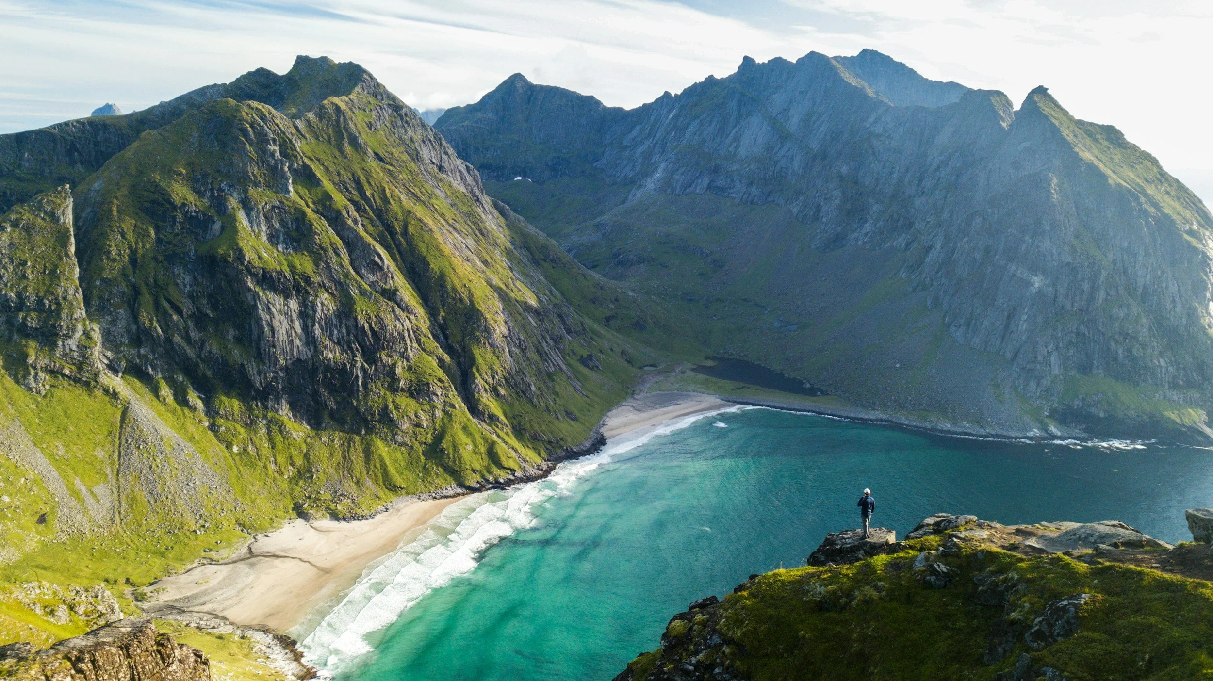
Remote landscapes such as Kvalvika are best experienced without haste, a reminder that time is one of the most valuable elements in a Norwegian itinerary.